
1635: "Nahanni: The River That Refused to Be Touched"
Interesting Things with JC #1635: "Nahanni: The River That Refused to Be Touched" – A river runs for hundreds of miles with no dams and no control, then suddenly drops nearly twice the height of Niagara while the land around it was never flattened by glaciers, leaving terrain that still acts differently and forces anyone who goes in to stay there for weeks
Curriculum - Episode Anchor
Episode Title: Nahanni: The River That Refused to Be Touched
Episode Number: 1635
Host: JC
Audience: Grades 9–12, Introductory College, Homeschool, Lifelong Learners
Subject Area: Earth Science / Geography / Environmental Studies
Lesson Overview
Objectives:
Analyze how geological processes shape river systems and landscapes
Explain how glacial history impacts modern terrain features
Evaluate human interaction with remote environments over time
Interpret how isolation affects ecosystems and perception
Essential Question:
How does an untouched river system reveal the relationship between geology, environment, and human experience?
Success Criteria:
Describe at least three geological features of the Nahanni region
Explain why the river remains undisturbed
Connect human history to environmental conditions
Student Relevance Statement:
Students learn how geography directly impacts survival, exploration, and environmental decision-making.
Real-World Connection:
Remote protected regions like Nahanni National Park Reserve show how conservation and land management operate without heavy infrastructure.
Workforce Reality:
Environmental scientists, geologists, and park managers often work in remote, physically demanding environments with limited support systems.
Key Vocabulary
Karst (karst): Landscape formed by dissolving rock creating caves and sinkholes
Tufa (TOO-fuh): Mineral deposits from spring water
Canyon (KAN-yun): Deep valley with steep sides
Glacier (GLAY-sher): Large moving mass of ice
Isolation (eye-soh-LAY-shun): Separation from infrastructure or population
Hydrology (hy-DRAH-luh-jee): Study of water systems
Sedimentation (sed-uh-men-TAY-shun): Settling of particles in water
Indigenous Knowledge (in-DIJ-uh-nus): Traditional environmental understanding
Narrative Core
Open:
Some rivers change to fit people. Others, like the South Nahanni River, do not.
Info:
This river cuts through mountains and drops dramatically at Virginia Falls, shaping a landscape largely untouched by modern engineering.
Details:
The region avoided glaciation, preserving sharp terrain and deep canyons. Karst systems formed underground networks, while mineral-rich springs built tufa formations over thousands of years. The Dehcho First Nations have navigated and understood this land for over 10,000 years.
Reflection:
Isolation preserves both natural systems and uncertainty. Where access is limited, stories and interpretations often fill gaps in knowledge.
Closing:
These are interesting things, with JC.
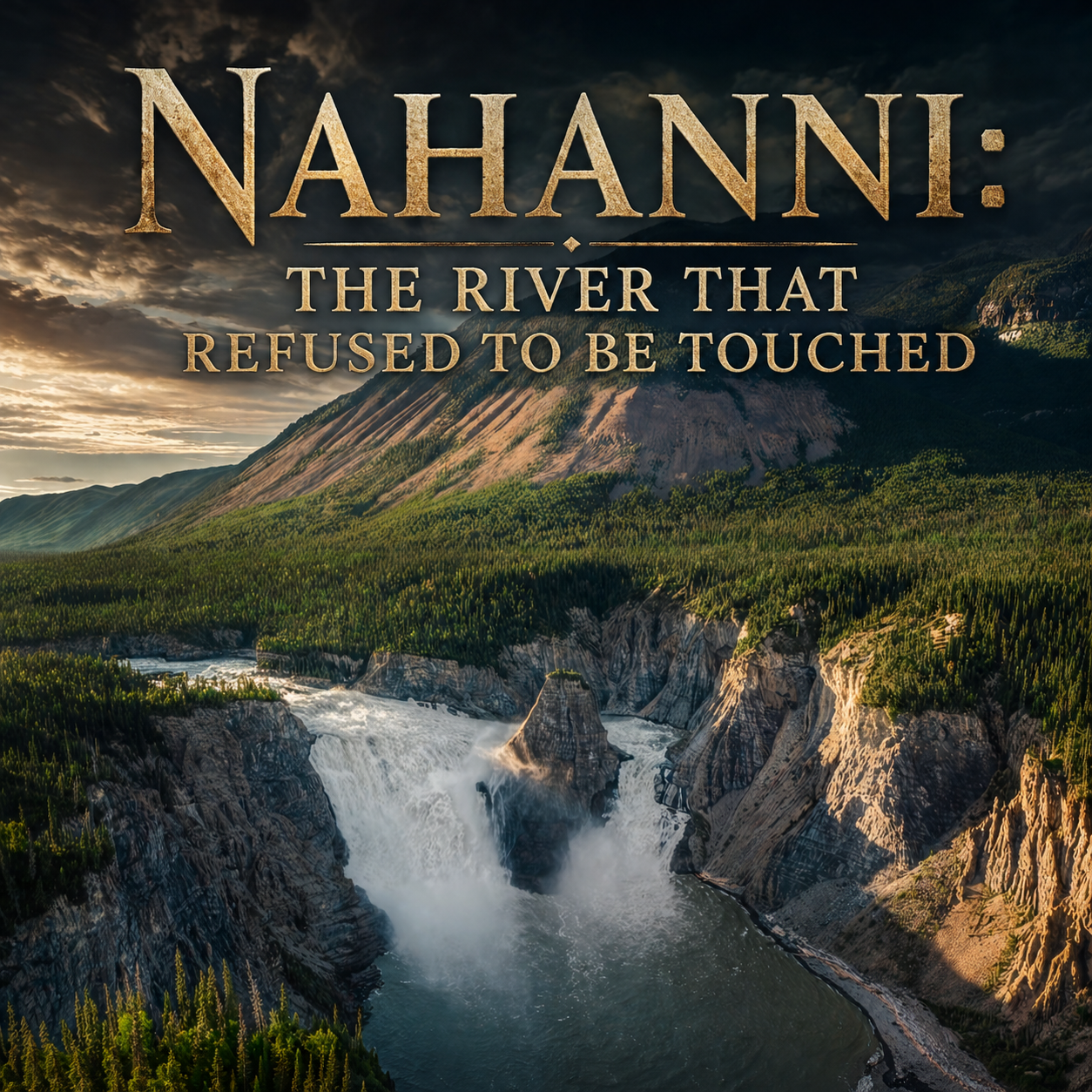
Snowmelt river plunging over a tall waterfall into a deep canyon, surrounded by dense forest and rugged mountains under dramatic skies, with title text “Nahanni: The River That Refused to Be Touched.”
Transcript
Interesting Things with JC #1635:
"Nahanni: The River That Refused to Be Touched"
The river doesn’t bend to people here. People bend to the river.
Way up in the southwest corner of Canada’s Northwest Territories, there’s a stretch of water that’s been running its course for a very long time, and it’s never once been redirected. The South Nahanni River runs about 560 kilometers, roughly 350 miles, with no dams, no rerouting, nothing trying to correct it. It cuts through four different mountain ranges, carving canyons that drop as deep as 1,200 meters, nearly 4,000 feet. That’s not just a number. That’s straight rock walls, colder air settling down low, and a river moving through the bottom like it’s locked into its path.
And then the ground just gives way.
At Náįlįcho (nye-LEE-cho), most people call it Virginia Falls, the river drops somewhere between 92 and 96 meters, about 300 to 315 feet. Niagara Falls sits at about 51 meters, 167 feet. This is almost double. And it doesn’t just pour over. It slams down. The impact throws mist into the air, and that mist hangs there, thick enough to change the ground around it. Inside that constant spray, you get a small pocket where plants grow that shouldn’t survive this far north, but they do because the conditions hold steady just enough.
That traces back to something that never reached this place.
During the last Ice Age, glaciers flattened huge parts of North America. But sections of Nahanni were left alone. No scraping, no leveling. So the ground behaves differently. The limestone slowly dissolves as slightly acidic water works through it, opening up karst systems—caves, sinkholes, and underground channels where water drops out of sight and comes back somewhere else. At Rabbitkettle, hot springs loaded with minerals build tufa mounds, layer by layer, over about 10,000 years. Each pass leaves a thin mineral edge, and over time those edges stack into shapes that look fixed, even though they’re still forming.
Long before anyone mapped any of this, the Dehcho Dene (DEH-cho DEN-eh) were already moving through here. For over 10,000 years, they used the river as a route, traveling in moose-hide boats that could reach about 20 meters, around 65 feet long. Whole families, tools, trade goods, everything in one vessel. And when the trip was over, the boat didn’t stay behind. It was taken apart and used again. Nothing wasted. Nothing left without purpose.
This isn’t just land to them. It’s understood. Some places are approached carefully. At the hot springs, offerings are still made.
Then in the early 1900s, outsiders came in chasing gold.
Some of them didn’t come back. In 1908, the McLeod brothers were found dead. In 1917, Martin Jorgenson turned up near a burned cabin. The details weren’t clear, but one part of the story spread fast. People said the bodies were found without their heads.
From there, the stories took off. A lost tribe called the Naha (NAH-hah). Unknown predators. Something guarding the valley. But underneath all that, the reality is simpler and harder at the same time. Remote terrain. Severe conditions. No real way to investigate properly back then. In a place this isolated, unanswered questions don’t stay quiet. People fill them in.
Even now, getting into Nahanni isn’t easy. There are no roads leading in. Most people arrive by floatplane. If you’re running the river, it can take anywhere from 7 to 21 days. You bring what you need, and you deal with whatever shows up—weather, current, distance. Once you’re in, you’re committed.
And that’s a big part of why it’s still like this.
Today, the park is co-managed by Parks Canada and the Dehcho First Nations, keeping a balance that most places lost a long time ago. The river still sets the rules. No shortcuts. No reshaping.
Just water, rock, and time, doing what they’ve always done.
These are interesting things, with JC.
Student Worksheet
Comprehension Questions:
How long is the South Nahanni River?
How tall is Virginia Falls compared to Niagara Falls?
Why did glaciers not reshape this region?
Analysis Questions:
4. How do karst systems change the landscape over time?
5. Why does isolation lead to myths or incomplete explanations?
Reflection Prompt:
6. Would you explore a place like Nahanni? Why or why not?
Difficulty Scaling:
Basic: Recall facts
Intermediate: Explain processes
Advanced: Evaluate environmental impact
Student Output:
Written responses (1–3 paragraphs for extended answers)
Academic Integrity Guidance:
Use original wording
Cite ideas from the transcript
Teacher Guide
Quick Start:
Play audio, then assign worksheet
Pacing (audio-first):
Bell ringer (5 min)
Audio (10 min)
Discussion (10 min)
Worksheet (15 min)
Bell Ringer:
What makes a place difficult to explore?
Audio Guidance:
Listen for environmental and human interaction details
Audio Fallback:
Use transcript reading
Materials:
Audio/transcript
Worksheet
Misconceptions:
Remote ≠ safe
Untouched ≠ unused
Discussion Prompts:
Why hasn’t the river been altered?
What risks exist in remote travel?
Formative Checks:
Verbal summaries
Worksheet review
Differentiation:
Simplified summaries
Extended research tasks
Engagement Strategy:
Mystery and exploration focus
Extensions:
Compare with other protected ecosystems
Cross-Curricular:
Geography, environmental science, history
SEL:
Risk awareness
Answer Key:
~560 km
Nearly twice as tall
Glaciers did not reach area
Creates caves and underground systems
Lack of data leads to speculation
Answers vary
Quiz
What type of terrain forms from dissolving limestone?
A. Desert
B. Karst
C. Tundra
D. PlateauVirginia Falls is approximately how tall?
A. 50 m
B. 75 m
C. 90–96 m
D. 200 mWhy is Nahanni unique?
A. Volcanic activity
B. No glaciers impacted it
C. It is underwater
D. It is urbanWho lived there for over 10,000 years?
A. Explorers
B. Settlers
C. Dehcho Dene
D. TradersWhy is it still unchanged?
A. No resources
B. Only laws
C. Isolation and difficulty
D. Weather only
Assessment
Open-Ended Questions:
How did geological history shape Nahanni’s landscape?
How does isolation influence both environment and human stories?
Rubric (3–2–1):
3: Clear, evidence-based
2: Partial understanding
1: Minimal response
Exit Ticket:
Name one factor that keeps the Nahanni River untouched.
Standards Alignment
NGSS HS-ESS2-1: Analyze how Earth’s internal and surface processes (erosion, weathering, hydrology) shape features like canyons and karst systems; students demonstrate by explaining Nahanni’s geological formation in writing.
NGSS HS-ESS2-2: Evaluate feedbacks between geosphere and hydrosphere; students model how river flow interacts with limestone to create caves and sinkholes.
NGSS HS-ESS3-1: Construct explanations for how natural resources and geography influence human activity; students connect isolation to limited development in Nahanni.
CCSS RST.11-12.1: Cite specific textual evidence; students support worksheet responses using transcript details.
CCSS RST.11-12.2: Determine central ideas; students summarize how geology and isolation define the region.
CCSS WHST.11-12.2: Write explanatory texts; students produce structured responses explaining environmental processes.
C3 D2.Geo.2.9-12: Use geographic representations to analyze spatial patterns; students interpret river systems and terrain features.
C3 D2.Geo.4.9-12: Analyze relationships between humans and environments; students evaluate Indigenous land use and modern conservation.
C3 D2.His.1.9-12: Evaluate historical context; students assess how early exploration shaped narratives about Nahanni.
ISTE 3a (Knowledge Constructor): Evaluate credibility of multiple sources; students compare scientific explanation vs. historical mystery accounts.
ISTE 4a (Innovative Designer): Use models or diagrams to represent geological systems; students sketch karst formation or river canyon structure.
Career Readiness (Environmental & Field Sciences):
Apply geospatial reasoning to real-world terrain
Interpret environmental data under uncertain conditions
Understand operational challenges in remote fieldwork
Homeschool / Lifelong Learning:
Develop independent inquiry by connecting narrative content to scientific concepts
Apply interdisciplinary thinking (science, history, geography)
Practice self-directed analysis through written and reflective tasks
Show Notes
This lesson explores a rare untouched river system and shows how geology, isolation, and human history intersect. Students examine how natural systems persist without interference and how humans adapt to extreme environments.
References
Dehcho First Nations. (n.d.). NNPR expansion. https://dehcho.org/nnpr-expansion/
EBSCO Information Services. (n.d.). Nahanni National Park | History. https://www.ebsco.com/research-starters/history/nahanni-national-park
National Geographic Society. (2011, July 6). Nahanni National Park Reserve. https://www.nationalgeographic.com/travel/article/nahanni-canada-park
Parks Canada. (2021). Nahanni National Park Reserve of Canada management plan. https://parks.canada.ca/pn-np/nt/nahanni/info/plan-2021
Parks Canada. (2026, March 6). Culture and history - Nahanni National Park Reserve. https://parks.canada.ca/pn-np/nt/nahanni/culture
Parks Canada. (2026, March 19). Nature and science - Nahanni National Park Reserve. https://parks.canada.ca/pn-np/nt/nahanni/nature
UNEP-WCMC. (2011, May). Nahanni National Park – World Heritage datasheet. http://world-heritage-datasheets.unep-wcmc.org/datasheet/output/site/nahanni-national-park/