1789: "The Lake Michigan Circle"
Interesting Things with JC #1789: "The Lake Michigan Circle"
Drive 1,100 miles around Lake Michigan through 4 states, or board a steamship where an official spur takes the Circle Tour off the road.
Curriculum - Episode Anchor
Episode Title: The Lake Michigan Circle
Episode Number: 1789
Series: Interesting Things with JC™
Host: JC
Audience: Grades 9–12, introductory college, homeschool, lifelong learners
Subject Areas: Geography, transportation history, environmental science, mathematics, information literacy
Essential Question: How does traveling around a lake reveal connections among geography, transportation, and water systems?
Lesson Length: 55 minutes; optional extension of 20–30 minutes
Episode Access: https://JimConnors.net
Attribution: © Jim Connors LLC. All Rights Reserved. Free classroom use with attribution; no resale.
Lesson Overview
Students use the episode as the starting point for a geographic investigation. They locate the four bordering states, distinguish a road circuit from a ferry crossing, calculate approximate travel requirements, and examine how numerical claims depend on definitions and sources.
Learning Objectives
Locate Illinois, Wisconsin, Michigan, and Indiana around Lake Michigan.
Explain how the Mackinac Bridge and S.S. Badger provide different transportation connections.
Convert distances and estimate driving time while stating assumptions.
Explain why an average water-retention time does not describe every individual drop.
Support an explanation with evidence from a map and at least two identified sources.
Success Criteria: An accurately labeled map, calculations with units, and a 100–150-word explanation connecting physical geography with transportation.
Key Vocabulary
Circle tour: A designated travel route that loops around a geographic feature.
Peninsula (puh-NIN-suh-luh): Land largely surrounded by water but connected to a larger landmass.
Strait: A narrow water passage connecting larger bodies of water.
Spur route: A branch connecting with a main route; this episode includes a ferry spur.
Car ferry: A vessel that carries vehicles and passengers across water.
Retention time: An estimate of how long water remains in a water body on average; also called residence time.
Volume: The amount of three-dimensional space occupied by something, measured here in cubic miles or cubic kilometers.
Infrastructure: Built systems, including roads, bridges, and ports, that support transportation and other activities.
Mackinac (MAK-uh-naw): The name of the straits and bridge between Michigan’s two peninsulas.
Manitowoc (MAN-ih-tuh-wok): The Wisconsin port connected with Ludington by the S.S. Badger.
Narrative Core
Opening Problem
A map makes Lake Michigan look easy to understand: water surrounded by land. Planning a trip around it requires a different kind of knowledge. Students must identify the states, crossing points, peninsulas, and transportation choices that turn a shoreline into a journey.
Reveal 1: Geography Shapes the Route
Lake Michigan lies entirely within the United States. The West Michigan Tourist Association identifies its tour as the first officially signed Great Lakes Circle Tour and dates the first guidebook to 1988. The lake existed long before the coordinated travel route and its signs. [1]
Reveal 2: Infrastructure Changes the Journey
The bridge connects Michigan’s Upper and Lower Peninsulas. The ferry connects ports on opposite shores. The West Michigan Tourist Association identifies the Badger crossing as a Circle Tour spur. Taking it can replace part of a shoreline journey, so a ferry trip is not automatically a complete circuit. [2–4]
Reveal 3: Water Has a Different Timescale
A visitor measures travel in hours and days. The Environmental Protection Agency lists Lake Michigan’s average retention time as 99 years. That estimate describes the water system as a whole; it is not a departure schedule for individual drops. [5]
Instructional Sequence: Listen → locate → calculate → check evidence → explain.
Closing Transfer: Apply the same approach to another lake, river, mountain pass, or transportation corridor.
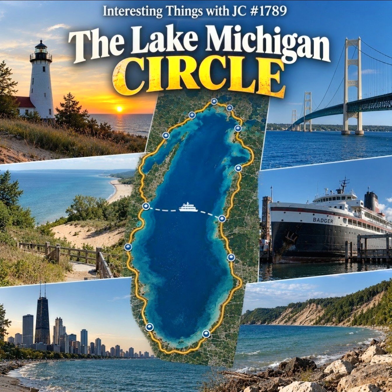
Cover art for Interesting Things with JC #1789: “The Lake Michigan Circle.” A photographic travel collage centers on an aerial-style map of Lake Michigan outlined by a bright yellow Circle Tour route with waypoint markers and a ferry crossing. Surrounding images show a Lake Michigan lighthouse at sunset, the Mackinac Bridge, the S.S. Badger ferry, sand dunes and shoreline, and the Chicago skyline. The title appears prominently across the upper portion of the image.
Transcript
Interesting Things with JC #1789:
"The Lake Michigan Circle"
You can drive all the way around Lake Michigan without ever leaving the United States, but it’s a pretty good haul. The Lake Michigan Circle Tour runs roughly 1,100 miles, or 1,770 kilometers, through Illinois, Wisconsin, Michigan, and Indiana, winding around Door County, across Michigan’s Upper Peninsula, over the Mackinac Bridge, and back down the other side.
The official route came together in the 1980s through the Michigan Department of Transportation and the West Michigan Tourist Association. It became the first officially signed Great Lakes Circle Tour, and because Lake Michigan is the only Great Lake entirely within the United States, it’s the only one you can circle without crossing into Canada.
And this is a big lake. It stretches about 307 miles, or 494 kilometers, north to south, reaches 923 feet, or 281 meters, at its deepest point, and holds roughly 1,180 cubic miles, or 4,920 cubic kilometers, of water. Even stranger, the average drop of water stays in Lake Michigan for about 99 years before moving on through the Great Lakes system.
Up north, the route crosses the five-mile Mackinac Bridge. Down at Ludington, there’s another option: drive your car aboard the 410-foot S.S. Badger, the last coal-fired passenger steamship operating in the United States, and take an official Circle Tour spur across the lake to Manitowoc, Wisconsin. The crossing takes about four hours.
Stay on the road and the tour passes more than a hundred lighthouses before those Circle Tour signs eventually bring you right back where you started.
By then, Lake Michigan isn’t just that big blue patch sitting next to Michigan on the weather map. You’ve spent 1,100 miles finding out what’s actually around it.
These are interesting things, with JC.
Student Worksheet
Name: ____________________
Date: ____________________
Comprehension
Name the four states bordering Lake Michigan. Explain why the full road circuit can remain within one country.
Using the West Michigan Tourist Association map, label the four states, Door Peninsula, Michigan’s Upper and Lower Peninsulas, Mackinac Bridge, Ludington, and Manitowoc. Trace a road circuit and draw the ferry connection with a dashed line. Include a legend and north arrow.
Explain the difference between the bridge connection and the ferry connection. Which one links Michigan’s two peninsulas?
Quantitative Analysis
Use 1 mile = 1.609344 kilometers to convert the episode’s approximate 1,100-mile route. Report the result to the nearest 10 kilometers and explain why extra decimal places would imply too much precision.
For a classroom model, assume an average driving speed of 55 miles per hour, approximately 89 kilometers per hour. Calculate the driving time for 1,100 miles. Name three things this estimate leaves out.
Divide the approximate route evenly across six driving days. Report the daily distance to the nearest mile and kilometer. Explain why a real itinerary might use unequal daily distances.
Source Analysis
Compare NOAA’s Lake Michigan maximum depth of 923 feet with the EPA table’s 925 feet. Record each source’s title and URL. What can you report confidently? What additional information would you need to explain the difference?
Explain why “the average retention time is 99 years” does not mean that all the lake’s water leaves together after 99 years.
Synthesis
Write 100–150 words answering the essential question. Include one map observation, one calculated result, and evidence from two references. Identify one limitation of your travel estimate.
Difficulty Scaling
Level 1: Use a partially labeled map, a calculator, and sentence starters.
Level 2: Complete all nine questions independently.
Level 3: Add a comparison of a road circuit and a ferry-assisted trip using the same endpoints. Identify the distance, schedule, loading, and stop-time information needed for a defensible comparison.
Student Output: Annotated map, numbered responses, calculations, and synthesis paragraph.
Academic Integrity Guidance: Cite information you use, show calculations, and distinguish source statements from your own interpretation. Do not invent an explanation for conflicting measurements.
Teacher Guide
Quick Start: Prepare the episode audio, transcript, West Michigan Tourist Association map, and short NOAA/EPA excerpts. Distribute only the Student Worksheet and Quiz to students; retain the answer keys.
Pacing Guide — Audio First
0–5 minutes: Ask students to predict which states border Lake Michigan and where a vehicle might cross water.
5–9 minutes: Play the episode; students record three geographic features and one surprising number.
9–14 minutes: Review vocabulary and distinguish a circuit from a crossing.
14–26 minutes: Complete worksheet questions 1–3 using the map.
26–34 minutes: Complete questions 4–6; compare assumptions.
34–43 minutes: Complete questions 7–8 using the source excerpts.
43–50 minutes: Write the synthesis paragraph.
50–55 minutes: Complete the quiz as an exit assessment.
Materials
Episode audio or teacher read-aloud and the supplied transcript.
Printed or digital West Michigan Tourist Association map and itinerary.
NOAA and EPA source excerpts.
Paper, pencil, and calculator; internet access is optional if excerpts are prepared.
Accuracy and Teaching Notes
Route distance: Use 1,100 miles, or 1,770 kilometers, as the episode’s approximate classroom input. Actual mileage depends on the selected route, loops, and stops; it is not the lake’s shoreline measurement.
Depth: NOAA’s Coast Pilot lists 923 feet, supporting the transcript; EPA lists 925 feet, or 282 meters. The difference is 2 feet, approximately 0.61 meter. Do not attribute it to a specific cause without examining the underlying measurement records. [5–6]
Lighthouses: The West Michigan Tourist Association describes more than 100 along the broader tour. Do not promise that every lighthouse is visible from the main road or publicly accessible; individual visits may require detours. [1–2]
Bridge length: About 5 miles, or 8 kilometers, describes the entire crossing. The main span between towers is 3,800 feet, or 1,158 meters. [3]
Ferry: The operator lists a four-hour crossing and a ship length of 410 feet, approximately 125 meters. Travel planning must also account for loading and the difference between Eastern and Central time. [4, 7]
Retention: The average does not imply that the lake empties and refills on a fixed cycle, or that a pollutant will necessarily remain for precisely the same duration.
Worksheet Answer Key
Illinois, Wisconsin, Michigan, and Indiana; the lake lies wholly within the United States.
Illinois is southwest, Wisconsin west, Michigan north/east, and Indiana south. Door Peninsula projects northeast in Wisconsin. Mackinac Bridge lies between Michigan’s peninsulas; Ludington is on the eastern shore and Manitowoc on the western shore. Compare the student circuit with the West Michigan Tourist Association map.
The bridge links the two peninsulas by road; the ferry transports vehicles across the lake between the two ports.
1,100 × 1.609344 = 1,770.2784 kilometers; approximately 1,770 kilometers. The input is already an estimate.
1,100 ÷ 55 = 20 hours of modeled driving. Stops, congestion, construction, and changing road speeds are acceptable limitations.
Approximately 183 miles or 295 kilometers per day. Lodging locations, attractions, road conditions, and desired stop durations can make unequal days sensible.
Both sources put maximum depth near 924 feet, roughly 282 meters. Retain each published value and attribution. Investigate survey methods, reference water levels, dates, and rounding before explaining the discrepancy.
The value describes an average for water moving through a system; individual water parcels can remain for different lengths of time.
Accept explanations that connect geography and transportation, use evidence accurately, include a valid calculation, and acknowledge a limitation.
Discussion Prompts
When can a shortcut prevent you from completing the trip you intended?
Why might a tourism map and a navigation publication emphasize different information?
Formative Checkpoints
Students distinguish road distance, lake length, and water depth.
Maps distinguish the road circuit from the ferry crossing.
Calculations include units and appropriate rounding.
Source disagreements produce questions rather than invented explanations.
Differentiation
Additional Support: Supply a word bank, worked conversion example, and enlarged map.
Advanced Learners: Investigate how definitions and measurement reference levels affect published lake statistics.
English Learners: Preview place names and pair vocabulary with map features.
Accessibility: Offer transcript access, high-contrast maps, patterns as well as color, and a spoken geographic description or accessible labeled list in place of hand drawing.
Homeschool/Lifelong Learning: Complete the map and calculations in one session, then discuss the sources and synthesis in a second session.
Quiz
Directions: Choose the best answer. Each question is worth 1 point.
Which state does NOT border Lake Michigan?
A. Indiana
B. Wisconsin
C. Ohio
D. IllinoisWhat does the Mackinac Bridge connect?
A. Illinois and Wisconsin
B. Michigan’s Upper and Lower Peninsulas
C. Ludington and Manitowoc
D. Michigan and CanadaAt an assumed average of 55 miles per hour, how much driving time does 1,100 miles require?
A. 10 hours
B. 15 hours
C. 20 hours
D. 25 hoursWhat does the 99-year retention estimate describe?
A. Every drop’s exact age
B. A lake-wide average timescale
C. How often the lake empties
D. The age of Lake MichiganTwo authoritative sources give slightly different maximum depths. What is the strongest response?
A. Invent a cause
B. Hide one figure
C. Assume both sources are useless
D. Attribute both values and investigate their measurement context
Answer Key
C. Ohio.
B. Michigan’s Upper and Lower Peninsulas.
C. 20 hours.
B. A lake-wide average timescale.
D. Attribute both values and investigate their measurement context.
Mastery Target: 4/5 or better, with reteaching for any misunderstanding about averages or evidence.
Assessment
Performance Task: Submit the worksheet map, calculations, source comparison, and synthesis paragraph.
Criterion 1: Geographic Accuracy
4 points — Strong: All required places and connections are accurately labeled.
3 points — Proficient: One minor error; the circuit and crossing are clearly distinguished.
2 points — Developing: Several errors or one unclear connection.
1 point — Beginning: Major locations or connections are missing.
Criterion 2: Quantitative Reasoning
4 points — Strong: Correct calculations, units, rounding, and assumptions.
3 points — Proficient: Mostly correct work with one minor omission.
2 points — Developing: Partial method with unit or arithmetic errors.
1 point — Beginning: Unsupported answers or no usable method.
Criterion 3: Evidence and Interpretation
4 points — Strong: Sources are identified; the depth discrepancy and retention average are interpreted accurately.
3 points — Proficient: Accurate interpretation with limited explanation.
2 points — Developing: Incomplete attribution or one misconception.
1 point — Beginning: Unsupported claims or major misconceptions.
Criterion 4: Synthesis
4 points — Strong: Clear geographic explanation with map evidence, a calculation, two sources, and a limitation.
3 points — Proficient: Clear explanation with one required element missing.
2 points — Developing: Partial explanation with multiple required elements missing.
1 point — Beginning: Minimal or unsupported explanation.
Scoring: 16 points; missing work earns 0 for the relevant criterion.
Suggested Proficiency: 12/16 or higher, with at least 3 points in evidence and interpretation.
Feedback Cycle: Revise one geographic error, one calculation or assumption, or one unsupported claim after feedback.
Standards Alignment
CCSS Reading — History/Social Studies
RH.9–10.1 — Key Ideas and Details: Students support their source comparison and synthesis with specific evidence and identify its origin.
RH.9–10.7 — Integration of Knowledge and Ideas: Students combine geographic prose, maps, and numerical analysis in one explanation. [8]
CCSS Writing — History/Social Studies, Science, and Technical Subjects
WHST.9–10.2 — Text Types and Purposes: Students produce an informative paragraph using geographic terms, evidence, and a coherent explanation. [9]
CCSS Mathematics — Quantities
HSN.Q.A.1 — Reason quantitatively and use units to solve problems: Students convert distances and calculate modeled travel time using consistent units.
HSN.Q.A.3 — Reason quantitatively and use units to solve problems: Students select reporting precision appropriate to an approximate route distance. [10]
NGSS — Science and Engineering Practices
Practice 8 — Obtaining, Evaluating, and Communicating Information: The depth comparison supports evaluating scientific claims and communicating source limitations. This is practice-level support, not completion of a full NGSS performance expectation. [11]
Instructional Progression: Recall locations → apply mathematics → analyze source differences → evaluate assumptions → construct an explanation.
Audience Adaptation: The cited literacy standards are a grades 9–10 baseline; grades 11–12 and college learners should complete the advanced comparison and justify source choices independently.
Show Notes
Episode Summary: A road circuit around Lake Michigan connects four states, major transportation crossings, and a freshwater system operating on a much longer timescale than a vacation.
Classroom Focus: U.S. geography, map interpretation, transportation choices, units, averages, and source evaluation.
Watch: https://www.youtube.com/@interestingthingswithjc
RSS, MP3, and Open Curriculum: https://JimConnors.net
Access: Free curriculum materials available on the website, no login, no paywall.
Use: Free classroom use with attribution to Interesting Things with JC and Jim Connors LLC; no resale.
Source Review Date: September 28, 2026.
References
Episode Source
JC. Interesting Things with JC #1789: “The Lake Michigan Circle.” Transcript supplied for this curriculum.
Geography, History, and Transportation
West Michigan Tourist Association. Lake Michigan Lighthouse Map & Circle Tour. Route origins, guidebook history, lighthouse overview, and map access.
https://www.wmta.org/lake-michigan-lighthouse-map-circle-tour/West Michigan Tourist Association. Lighthouse Driving Itinerary. Route connections and the S.S. Badger spur.
https://www.wmta.org/lake-michigan-lighthouse-map-circle-tour/lighthouse-driving-itinerary/Mackinac Bridge Authority. Facts & Figures. Total bridge length and main-span dimensions.
https://www.mackinacbridge.org/history/facts-figures/Lake Michigan Carferry. S.S. Badger. Ports, crossing duration, and time-zone information.
https://ssbadger.com/U.S. Environmental Protection Agency. Physical Features of the Great Lakes. Lake Michigan volume, retention estimate, and EPA depth figure.
https://www.epa.gov/greatlakes/physical-features-great-lakesNOAA, Office of Coast Survey. United States Coast Pilot 6, 2026 edition, Chapter 11, Lake Michigan. Chapter opening, printed page 337: lake length and maximum recorded depth.
https://nauticalcharts.noaa.gov/publications/coast-pilot/files/cp6/CPB6_WEB.pdfLake Michigan Carferry. History. S.S. Badger dimensions and operating history.
https://ssbadger.com/history/
Standards Sources
Common Core State Standards Initiative. History/Social Studies, Grades 9–10.
https://www.thecorestandards.org/ELA-Literacy/RH/9-10/Common Core State Standards Initiative. Writing, Grades 9–10, WHST.
https://www.thecorestandards.org/ELA-Literacy/WHST/9-10/Common Core State Standards Initiative. High School: Number and Quantity, Quantities.
https://www.thecorestandards.org/Math/Content/HSN/Q/NGSS Lead States. Appendix F: Science and Engineering Practices in the NGSS. Practice 8, pages 15–16.
https://www.nextgenscience.org/sites/default/files/Appendix%20F%20%20Science%20and%20Engineering%20Practices%20in%20the%20NGSS%20-%20FINAL%20060513.pdf