
1638: "Route 66 Turns 100"
Interesting Things with JC #1638: "Route 66 Turns 100" – Route 66 was stitched together from wagon trails, trading paths, and desert camel routes before becoming the first fully paved transcontinental highway in America. A century later, the old road still runs through the towns, diners, ruins, and forgotten stretches the interstate system went around.
Curriculum - Episode Anchor
Episode Title: Route 66 Turns 100
Episode Number: 1638
Host: JC
Audience: Grades 9–12, Introductory College, Homeschool, Lifelong Learners
Subject Area: American History, Transportation History, Geography, Cultural Studies
Lesson Overview
Learning Objectives:
Explain how Route 66 developed from earlier transportation routes into a national highway.
Analyze how transportation systems affect communities, migration, and economic growth.
Evaluate the historical significance of Route 66 during the Dust Bowl and Interstate eras.
Identify how infrastructure changes reshape regional economies and cultural identity.
Essential Question:
How did Route 66 shape American travel, migration, and local communities across the twentieth century?
Success Criteria:
Students can describe at least three historical roles of Route 66.
Students can explain how the Interstate Highway System changed small towns.
Students can connect transportation systems to economic and cultural change.
Student Relevance Statement:
Students regularly depend on transportation systems without considering how roads influence jobs, migration, tourism, and daily life.
Real-World Connection:
Modern highways, logistics systems, and transportation planning continue to affect economic opportunity, tourism, and regional development.
Workforce Reality:
Transportation historians, civil engineers, urban planners, archaeologists, and tourism professionals study and maintain infrastructure systems that influence communities.
Key Vocabulary
Transcontinental(tranz-kon-tuh-NEN-tul) — Extending across an entire continent.
Infrastructure(IN-fruh-struk-cher) — Physical systems such as roads, bridges, and utilities that support society.
Dust Bowl(DUST bohl) — Environmental disaster of the 1930s that caused severe dust storms and migration from the Great Plains.
Interstate System(IN-ter-stayt SIS-tum) — Network of high-speed highways built across the United States beginning in the 1950s.
Archaeology(ahr-kee-OL-uh-jee) — Study of human history through artifacts and physical remains.
Migration(my-GRAY-shun) — Movement of people from one region to another.
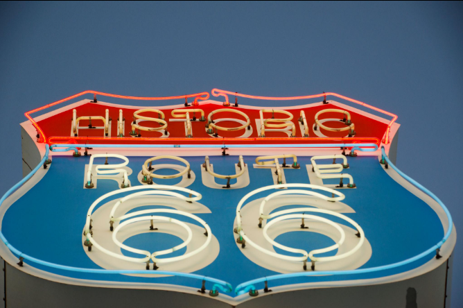
Neon Sign(NEE-on syne) — Electrically lit advertising sign common along historic highways.
Jim Crow Era(jim kroh AIR-uh) — Period of legalized racial segregation in the United States.
Realignment(ree-uh-LINE-ment) — Change in the route or direction of a roadway.
Narrative Core
Open:
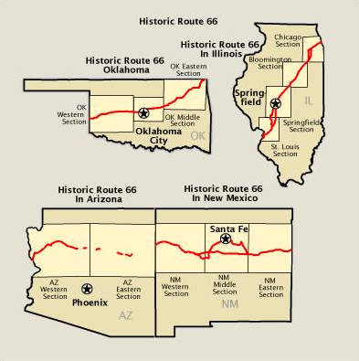
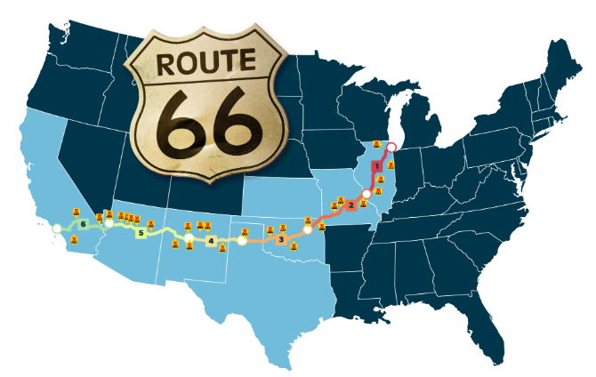
Route 66 became one of the most recognized highways in American history, stretching from Chicago to Santa Monica and connecting towns across eight states.
Info:
Established in 1926, the highway combined older roads, wagon trails, and trade paths into a continuous route. Some sections even followed routes first explored by U.S. Army expeditions in the nineteenth century.
Details:
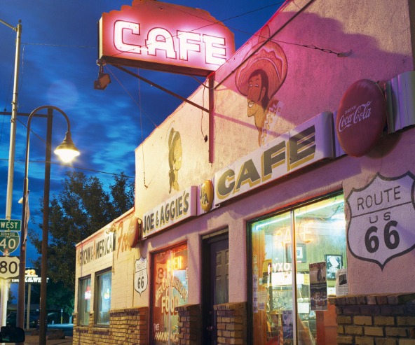
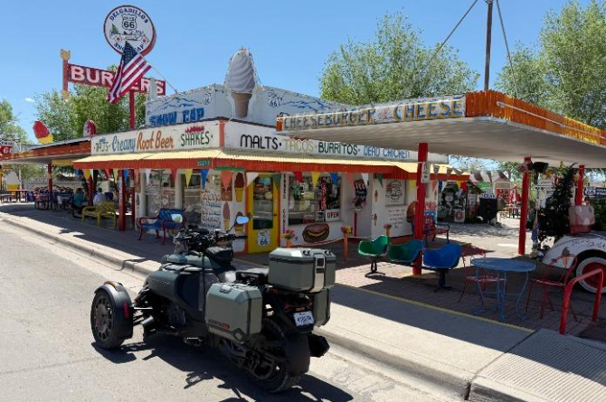
The road played a major role during the Dust Bowl migration, helped develop roadside businesses, and became known for diners, motels, and neon attractions. Route 66 also reflected the inequalities of its time, including the need for safe travel stops for Black Americans during segregation. Later, the Interstate Highway System bypassed many towns that depended on highway traffic.
Reflection:
Route 66 represents more than a road. It reflects migration, economic growth, cultural identity, technological change, and the shifting priorities of transportation in the United States.
Closing:
These are interesting things, with JC.
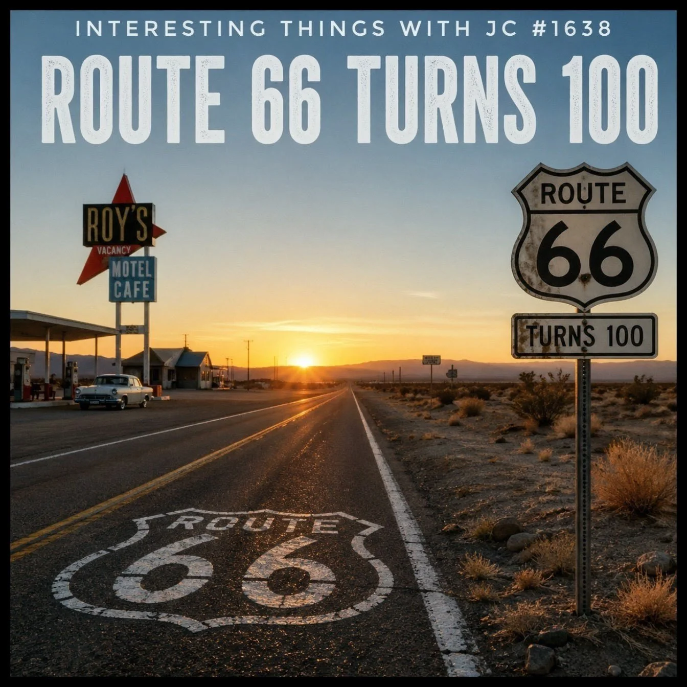
Promotional image for “Interesting Things with JC #1638: Route 66 Turns 100.” A sunset view of historic Route 66 stretches through a desert landscape with vintage roadside signs, a classic motel café, and Route 66 highway markers highlighting the road’s 100th anniversary.
Transcript
Interesting Things with JC #1638:
Route 66 Turns 100
There’s a spot in Albuquerque where Route 66 crosses Route 66.
At Central Avenue and 4th Street, the highway literally intersects itself. The route was realigned there in 1937.
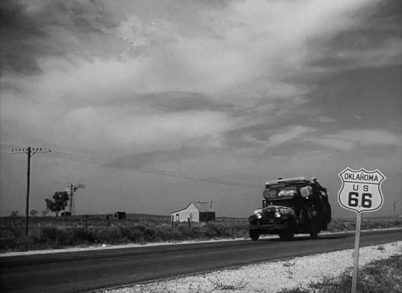
When Route 66 was established on November 11, 1926, it wasn’t a brand-new road. It was pieced together from old wagon trails, trading paths, and existing state highways. In the Southwest, parts of it followed a route opened in 1857 by Lieutenant Edward Beale and his U.S. Army camel caravan.
The Mother Road stretched 2,448 miles, about 3,940 kilometers, from Chicago to Santa Monica, passing through eight states. By 1938, it became the first fully paved transcontinental highway in the United States.
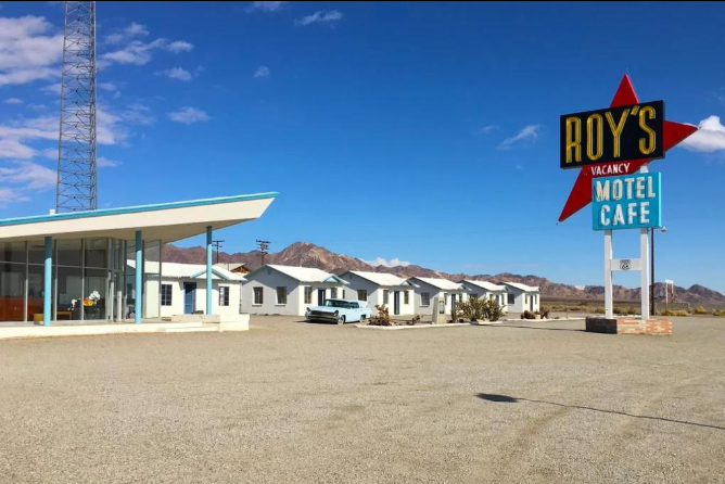
During the Dust Bowl, families drove west on what John Steinbeck later called the “Mother Road” in The Grapes of Wrath. Along the way, small towns filled with motels, diners, gas stations, and neon signs.
Not every stop along the road felt the same to the people using it.
Near Luther, Oklahoma, the Threatt Filling Station stood out as the only known Black-owned gas station on Route 66 during the Jim Crow era, a safe stop for Black travelers.
In the late 1920s, promoters staged a transcontinental foot race, the famous Bunion Derby, to advertise the new highway. Hundreds of runners set out on foot to promote a road built for cars.
At Petrified Forest National Park, archaeologists documented more than 11,000 artifacts along six miles of the old Route 66 roadway. Beer cans. Broken glass. Mufflers. Pieces of wrecks left behind in the desert. It’s the only national park the highway passes through.
Then the interstate system arrived.
The new highways bypassed the towns that depended on Route 66. Businesses collapsed almost overnight. On June 26, 1985, the Mother Road was officially removed from the federal highway system.
Now, in 2026, Route 66 turns 100 years old.
In Missouri, one surviving stretch of original 1926 concrete pavement is celebrating a triple anniversary: the highway, the pavement itself, and a nearby family business, all still standing after a full century together.
The interstate made the trip faster.
Route 66 still lets you see the country before everything started getting bypassed.
These are interesting things, with JC.
Student Worksheet
Comprehension Questions:
When was Route 66 officially established?
How long was Route 66?
Why did families travel Route 66 during the Dust Bowl?
What was the purpose of the Bunion Derby?
Why did many Route 66 towns decline after the Interstate System was built?
Analysis Questions:
How did Route 66 influence economic growth in small towns?
Why might Route 66 still hold cultural importance today?
What does the Threatt Filling Station reveal about travel during segregation?
Reflection Prompt:
Describe a modern transportation system that affects your community. How does it shape jobs, travel, or local businesses?
Difficulty Scaling:
Foundational: Identify major facts and vocabulary.
Intermediate: Explain cause-and-effect relationships.
Advanced: Compare Route 66 with modern transportation networks.
Student Output:
Students will complete written responses using evidence from the transcript and lesson discussion.
Academic Integrity Guidance:
Students should use their own words, cite evidence from the lesson, and avoid copying responses from classmates or online summaries.
Teacher Guide
Quick Start:
Play the podcast episode first. Follow with vocabulary review, discussion, and worksheet analysis.
Pacing Guide:
Bell Ringer — 5 minutes
Vocabulary Preview — 10 minutes
Podcast Listening — 10 minutes
Discussion — 15 minutes
Worksheet Completion — 15 minutes
Assessment and Exit Ticket — 10 minutes
Bell Ringer:
Ask students: “How do highways affect the success or decline of towns and businesses?”
Audio Guidance:
Encourage students to listen for examples of historical change, migration, and economic impact.
Audio Fallback:
Use the transcript for close reading if audio playback is unavailable.
Time on Task:
Approximately 60–65 minutes.
Materials:
Podcast audio or transcript
Student worksheet
Map of Route 66
Writing materials
Vocabulary Strategy:
Preview transportation and migration vocabulary before listening.
Misconceptions:
Students may think Route 66 was entirely new construction.
Students may assume highways always help local economies equally.
Students may overlook how segregation affected travel experiences.
Discussion Prompts:
Why did Route 66 become culturally important?
How did Interstate highways change American travel habits?
What happens when infrastructure bypasses communities?
Formative Checkpoints:
Vocabulary understanding
Discussion participation
Evidence-based worksheet responses
Differentiation:
Provide guided notes for emerging learners.
Allow verbal responses when needed.
Offer extension research for advanced students.
Assessment Differentiation:
Students may complete written, verbal, or presentation-based responses.
Time Flexibility:
Lesson may be shortened by assigning worksheet analysis as homework.
Substitute Readiness:
The transcript and worksheet provide complete standalone instruction.
Engagement Strategy:
Use historical images or maps of roadside attractions to build visual context.
Extensions:
Research preserved sections of Route 66.
Compare Route 66 with modern interstate highways.
Investigate regional tourism connected to historic roads.
Cross-Curricular Connections:
Geography: Mapping migration routes
Economics: Tourism and local business impact
Engineering: Highway construction and infrastructure
SEL Connection:
Students examine how transportation systems influence families, opportunity, and community identity.
Skill Value Emphasis:
Critical thinking, historical analysis, geographic reasoning, and evidence-based discussion.
Answer Key:
November 11, 1926
2,448 miles
To migrate west during the Dust Bowl
To advertise Route 66
Interstate highways bypassed local towns and businesses
Quiz
What year was Route 66 established?
A. 1918
B. 1926
C. 1938
D. 1956Which book referred to Route 66 as the “Mother Road”?
A. Moby-Dick
B. The Great Gatsby
C. The Grapes of Wrath
D. WaldenWhat event helped advertise Route 66 in the late 1920s?
A. Gold Rush
B. Pony Express
C. Bunion Derby
D. Apollo ProgramWhat caused many Route 66 towns to decline?
A. Railroad closures
B. Interstate highways bypassing towns
C. Flooding
D. Airline travelWhich national park contains a preserved section of Route 66?
A. Yellowstone National Park
B. Yosemite National Park
C. Grand Canyon National Park
D. Petrified Forest National Park
Assessment
Open-Ended Questions:
Explain how Route 66 reflected both opportunity and inequality in American history.
Analyze the economic impact Interstate highways had on Route 66 communities.
Rubric:
3 = Accurate explanation with detailed evidence and historical reasoning
2 = Mostly accurate explanation with some supporting evidence
1 = Limited explanation with minimal evidence
Exit Ticket:
Write one sentence explaining why Route 66 remains historically important today.
Standards Alignment
CCSS.ELA-LITERACY.RH.9-10.1: Cite specific textual evidence to support analysis of primary and secondary historical sources related to Route 66, migration, and transportation infrastructure.
CCSS.ELA-LITERACY.RH.9-10.2: Determine the central ideas of historical texts and summarize how Route 66 influenced migration, commerce, and tourism.
CCSS.ELA-LITERACY.RH.11-12.3: Evaluate how historical events such as the Dust Bowl and Interstate Highway construction shaped communities and economic systems.
CCSS.ELA-LITERACY.RH.11-12.7: Integrate information from maps, audio, photographs, and historical texts to analyze transportation history.
CCSS.ELA-LITERACY.SL.9-10.1: Initiate and participate effectively in collaborative discussions about infrastructure, migration, and regional development.
CCSS.ELA-LITERACY.W.9-10.2: Write explanatory texts examining the impact of Route 66 on American culture and economics.
C3 Framework D2.Geo.1.9-12: Use geographic representations and spatial thinking to analyze transportation routes and migration patterns.
C3 Framework D2.Geo.5.9-12: Evaluate how human activity and infrastructure alter regional development and settlement.
C3 Framework D2.His.1.9-12: Analyze historical events and developments within broader historical contexts involving transportation and economic change.
C3 Framework D2.His.14.9-12: Analyze multiple causes and effects of historical events, including the rise of Interstate highways and the decline of Route 66 communities.
C3 Framework D2.Eco.1.9-12: Analyze how incentives and economic systems influence local businesses and tourism industries.
ISTE 1.3 Knowledge Constructor: Evaluate historical information from audio, text, maps, and visual sources to develop evidence-based conclusions.
ISTE 1.6 Creative Communicator: Communicate historical understanding using written analysis, discussion, or multimedia presentation formats.
ISTE 1.7 Global Collaborator: Work collaboratively to examine how transportation systems connect regions and communities.
NGSS HS-ETS1-1: Analyze major technological systems, including highways and transportation infrastructure, to address human mobility and economic needs.
NGSS HS-ETS1-3: Evaluate solutions to complex societal problems involving transportation efficiency, accessibility, and infrastructure planning.
Career Readiness Standard: Develop understanding of careers connected to civil engineering, transportation logistics, tourism management, archaeology, and urban planning.
CTE Transportation Cluster Standard: Examine how transportation systems support economic activity, travel safety, infrastructure maintenance, and regional development.
Homeschool/Lifelong Learning Alignment: Promote interdisciplinary inquiry through independent analysis of history, geography, economics, engineering, and culture connected to Route 66.
Media Literacy Alignment: Analyze how storytelling, photography, maps, and podcast media shape public understanding of historical events and places.
Historical Thinking Skill Alignment: Distinguish between continuity and change over time by comparing Route 66 with modern Interstate systems.
Show Notes
This lesson explores the history and cultural impact of Route 66 as it reaches its 100th anniversary in 2026. Students examine migration, transportation infrastructure, economic development, segregation, tourism, and the rise of the Interstate Highway System. The episode demonstrates how one highway became a symbol of American travel while also revealing how infrastructure changes can reshape entire communities.
References
National Park Service. (2021). Route 66: 1926–1945. https://www.nps.gov/articles/route-66-1926-1945.htm
National Trust for Historic Preservation. (2023). Preserving the Threatt Filling Station on Route 66. https://savingplaces.org/stories/preserving-threatt-filling-station-hope-crew
Northern Arizona University Cline Library. (n.d.). Route 66: Promoting the road. https://library.nau.edu/speccoll/exhibits/route66/promotion.html
Steinbeck, J. (1939). The grapes of wrath. Viking Press. https://books.google.com/books/about/The_Grapes_of_Wrath.html?id=brHqUgNgfkQC
Visit Albuquerque. (2025). Stand at the corner of Route 66 and Route 66 in Albuquerque. https://www.visitalbuquerque.org/abq365/blog/post/stand-at-the-corner-of-route-66-and-route-66-in-albuquerque/