1721: "The Naming of Cleveland"
Interesting Things with JC #1721: "The Naming of Cleveland"
A surveying party names a new settlement after General Moses Cleaveland even though he wanted a different name, then he leaves and never returns. Over time, the city drops a letter from his name, while generations of settlers transform a frontier village into one of America's largest metropolitan areas.
Curriculum - Episode Anchor
Episode Title: The Naming of Cleveland
Episode Number: 1721
Host: Jim Connors (JC)
Audience: Grades 9–12, Introductory College, Homeschool, Lifelong Learners
Subject Area: United States History, Geography, Early American Expansion, Historical Geography
Lesson Overview
Objectives:
Explain how the Connecticut Land Company established the settlement that became Cleveland.
Describe the role of General Moses Cleaveland in surveying the Connecticut Western Reserve.
Evaluate how geography influenced the selection of early American settlements.
Analyze how communities develop identities that extend beyond their founders.
Essential Question:
How can a place be shaped by both the people who establish it and the generations who follow?
Success Criteria:
Identify why the settlement was founded where it was.
Explain why the city was originally named Cleaveland.
Describe how the spelling evolved into Cleveland.
Distinguish between historical fact and popular legend regarding the city's name.
Student Relevance Statement:
Many towns, schools, roads, and landmarks are named after individuals whose personal connection to those places was brief. Understanding how names are chosen helps students see how history influences the communities they live in today.
Real-World Connection:
City planning, surveying, geography, land ownership, and historical preservation all continue to rely on many of the same principles established during America's early expansion.
Workforce Reality:
Professional surveyors, GIS specialists, urban planners, historians, archivists, attorneys, and civil engineers all study historical land records to understand property boundaries and community development.
Key Vocabulary
Connecticut Western Reserve(kuh-NEHT-ih-kuht WES-tern ree-ZERV) — Land in present-day northeastern Ohio retained by Connecticut after the American Revolution.
Surveyor(ser-VAY-er) — A professional who measures and maps land.
Township(TOWN-ship) — A surveyed division of land used for settlement and administration.
Cuyahoga River(KY-uh-HOH-guh) — River flowing into Lake Erie where Cleveland was established.
Connecticut Land Company(kuh-NEHT-ih-kuht LAND KUHM-puh-nee) — Private company responsible for surveying and selling the Western Reserve.
Frontier(fruhn-TEER) — The edge of settled territory during westward expansion.
Masthead(MAST-hed) — The title section appearing at the top of a newspaper.
Metropolitan Area(meh-truh-PAHL-ih-tuhn AIR-ee-uh) — A city and its surrounding economically connected communities.
Narrative Core
Open:
The names of cities often seem permanent, but every name has a story. Some honor founders, others reflect geography, and many evolve over time. Cleveland's story includes all three.
Info:
In 1796, surveyors working for the Connecticut Land Company arrived at the mouth of the Cuyahoga River to divide nearly three million acres of the Connecticut Western Reserve into organized townships. Their work would prepare the land for settlement.
Details:
The expedition was led by General Moses Cleaveland, a Revolutionary War veteran and attorney. After studying the area's geography, the surveyors recognized that the Cuyahoga River offered access to Lake Erie, protected navigation, and future commercial opportunities. Although Cleaveland reportedly preferred naming the settlement "Cuyahoga," the surveying party voted to honor him instead. On July 22, 1796, the settlement was officially recorded as Cleaveland.
Cleaveland's personal connection to the settlement was surprisingly brief. He returned to Connecticut before the year ended and never returned to Ohio. He died in 1806 without witnessing the city's later growth.
The city's spelling also evolved. While many people repeat the story that a newspaper removed the first "a" because "Cleaveland" would not fit across its masthead, historians have found both spellings appearing simultaneously for years. By the 1830s, common usage gradually established "Cleveland" as the accepted spelling without any formal government action.
Reflection:
Cleveland demonstrates that communities are shaped by more than the people whose names they bear. Geography created opportunity, settlers built neighborhoods and businesses, and generations of residents transformed a frontier settlement into one of America's major cities.
Closing:
These are interesting things, with JC.
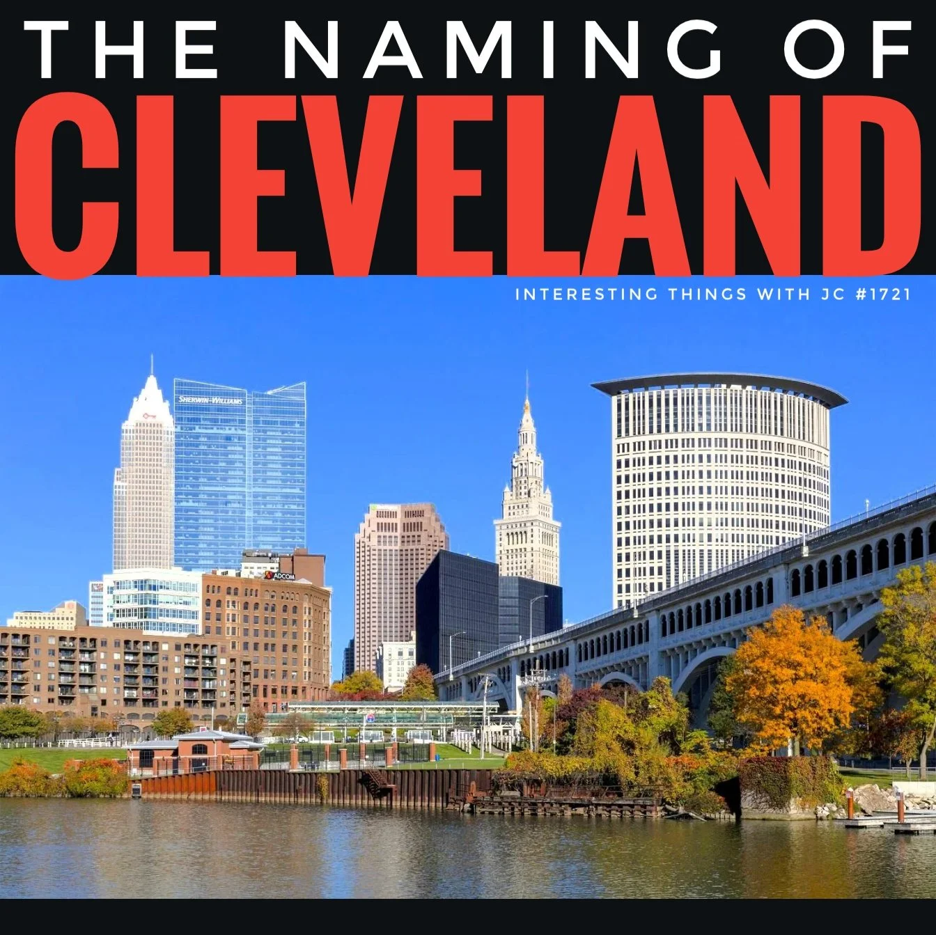
Cover art for Interesting Things with JC episode #1721, "The Naming of Cleveland." Large white text reading "THE NAMING OF" appears above oversized red text reading "CLEVELAND" on a black background. A panoramic color photograph below shows downtown Cleveland, Ohio, viewed across the Cuyahoga River. Visible landmarks include modern office towers, the Terminal Tower, Key Tower, the Sherwin-Williams headquarters, and the Hope Memorial Bridge, with autumn-colored trees lining the riverfront under a clear blue sky. Small white text reads "Interesting Things with JC #1721." This image is included solely for educational and informational purposes in connection with the historical content of this episode. No commercial use or endorsement is intended, and any copyrighted material is used in accordance with applicable fair use principles.
Transcript
Interesting Things with JC #1721:
"The Naming of Cleveland"
In the summer of 1796, surveyors for the Connecticut Land Company arrived at the mouth of the Cuyahoga River to survey Connecticut's Western Reserve, nearly 3 million acres (about 1.2 million hectares) that Connecticut had retained after surrendering most of its western claims. Their job was to divide the land into townships, establish property lines, and prepare it for settlement.
The expedition was led by General Moses Cleaveland, a Revolutionary War veteran, attorney, and shareholder in the company. After examining the area where the Cuyahoga River entered Lake Erie, the surveyors chose it as the site for a new settlement because it offered a protected river, access to the Great Lakes, and the potential to become a center of trade. Although Cleaveland reportedly preferred the name Cuyahoga, the surveying party voted to name the settlement after him. On July 22, 1796, it was officially recorded as Cleaveland.
That was almost the end of Moses Cleaveland's connection to the place. He returned to Connecticut before the end of the year and never came back. He died in 1806 without seeing the settlement grow beyond a frontier village.
Even the name did not remain exactly as he left it. A popular story claims an early newspaper dropped the first "a" because Cleaveland was too long to fit across its masthead. Historians have found the shorter spelling in use before that, and for years both versions appeared on maps, deeds, newspapers, and legal records. By the 1830s, Cleveland had become the accepted spelling through common usage rather than official action.
Today, Cleveland is home to hundreds of thousands of people, with more than two million living across its metropolitan area. Yet its name still belongs to a surveyor who spent only a few months there and never returned. Moses Cleaveland gave the city its name. The people who followed gave it its identity.
These are interesting things, with JC.
Student Worksheet
Instructions: Listen to the podcast episode first. As you listen, record important details about the founding of Cleveland. If audio is unavailable, read the transcript before completing the activities. Answer all questions using complete sentences and evidence from the episode.
Learning Target: I can explain how geography, surveying, and historical decisions contributed to the founding and naming of Cleveland.
Comprehension
Why did the Connecticut Land Company send surveyors to the Western Reserve?
Who led the surveying expedition?
Why did the surveyors select the mouth of the Cuyahoga River as the location for a settlement?
What name did Moses Cleaveland reportedly prefer for the settlement?
On what date was the settlement officially recorded as Cleaveland?
Why did Moses Cleaveland never witness the city's growth?
What is the popular story about the spelling change from "Cleaveland" to "Cleveland"?
What evidence suggests that story is probably incomplete?
By approximately what decade had "Cleveland" become the accepted spelling?
According to the episode, who ultimately gave Cleveland its identity?
Analysis
Why was access to Lake Erie an important advantage for a new settlement?
Explain how geography influenced the surveyors' decision more than personal preference.
Why might naming a town after a person have been common during early American settlement?
What does the gradual change in spelling tell us about how language evolves?
Explain the difference between founding a city and shaping its identity.
Reflection
Think about your own community. Is it named after a person, geographic feature, or something else? Research its origin and compare it to Cleveland's story.
Do you think Cleveland should have been named "Cuyahoga" instead? Support your opinion with historical evidence.
Difficulty Scaling
Level 1: Complete the comprehension questions.
Level 2: Complete comprehension and analysis.
Level 3: Complete all sections and write a one-page explanation describing how geography influenced the development of Cleveland.
Student Output Expectations
Students should produce:
Complete written responses
Evidence from the transcript
Historical reasoning supported by facts
Clear explanations rather than one-word answers
Academic Integrity Guidance
Use the transcript and lesson materials as evidence.
Cite facts accurately.
Distinguish historical evidence from popular legend.
Complete reflection responses using your own thinking.
Teacher Guide
Quick Start: Begin class by playing the podcast episode in its entirety. Ask students to listen specifically for why the settlement was located where it was rather than simply remembering names and dates.
Pacing Guide (Audio-First):
Bell Ringer — 5 minutes
Vocabulary Preview — 5 minutes
Podcast Listening — 6 minutes
Guided Discussion — 10 minutes
Student Worksheet — 20 minutes
Review and Reflection — 8 minutes
Exit Ticket — 6 minutes
Total Time: Approximately 60 minutes
Bell Ringer:
Display the question:
"Why do cities have the names they do?"
Students write three possible reasons before listening.
Audio Guidance:
Encourage students to listen for:
Geographic clues
Historical decisions
Cause-and-effect relationships
Differences between historical evidence and popular stories
Audio Fallback:
If audio cannot be played:
Read the transcript aloud.
Assign silent reading.
Conduct discussion using the transcript as the primary source.
Time on Task
Vocabulary: 5 minutes
Listening: 6 minutes
Discussion: 10 minutes
Independent Work: 20 minutes
Assessment: 19 minutes
Materials
Podcast audio
Transcript
Student worksheet
Map of the Great Lakes
Map of the Connecticut Western Reserve
Ohio state map
Highlighters
Notebook paper
Vocabulary Preparation
Introduce each vocabulary word before listening. Ask students to identify each term as it appears during the episode.
Common Misconceptions
Moses Cleaveland did not found a large city; he supervised the initial survey.
Cleveland was not immediately a major commercial center.
The spelling change was not the result of one officially documented decision.
The newspaper masthead story remains a popular legend rather than a confirmed historical fact.
Discussion Prompts
Why was the Cuyahoga River strategically valuable?
Why would surveyors carefully study geography before selecting a settlement?
How do myths become accepted as historical fact?
Can a city's identity become independent of its founder? Explain.
Formative Checkpoints
Students should be able to:
Explain the purpose of land surveying.
Locate the Cuyahoga River on a map.
Describe why waterways mattered in early America.
Explain why historians evaluate evidence before accepting popular stories.
Differentiation
For additional support:
Provide vocabulary cards.
Allow partner discussion.
Highlight key transcript passages.
Use guided note-taking.
For enrichment:
Research additional cities named after individuals.
Compare Cleveland with Pittsburgh, Buffalo, Detroit, or Chicago.
Investigate how survey systems shaped western expansion.
Assessment Differentiation
Oral responses
Graphic organizers
Short essays
Presentation option
Illustrated historical timeline
Time Flexibility
30-minute class:
Audio
Vocabulary
Comprehension only
60-minute class:
Complete lesson
90-minute class:
Add mapping activity and research extension
Substitute Readiness
This lesson is fully self-contained. If the teacher is absent:
Play the episode.
Distribute the transcript.
Complete the worksheet.
Review discussion questions.
Collect the exit ticket.
Engagement Strategy
Provide students with historical maps of Ohio before and after settlement. Ask them to identify how waterways influenced population growth and trade routes.
Extensions
Research the Connecticut Western Reserve.
Compare Cleveland's naming with Columbus or Cincinnati.
Explore how surveying technology has changed since 1796.
Create a timeline of Cleveland's early development.
Cross-Curricular Connections
Geography: Great Lakes transportation
Economics: Trade and settlement
Government: Land ownership and property law
Engineering: Surveying methods
English Language Arts: Evaluating historical narratives
SEL Connection
Students recognize that communities develop through the efforts of many people over time, encouraging appreciation for civic responsibility and shared identity.
Skill Value Emphasis
Students practice:
Critical thinking
Historical analysis
Geographic reasoning
Evidence evaluation
Source interpretation
Communication
Analytical writing
Answer Key
Comprehension
To survey and prepare land for settlement.
General Moses Cleaveland.
Protected river, Great Lakes access, and trade potential.
Cuyahoga.
July 22, 1796.
He returned to Connecticut and never came back.
A newspaper supposedly removed the "a" because the name was too long for its masthead.
Both spellings appeared simultaneously in historical records before the newspaper story.
The 1830s.
The generations of settlers and residents who followed.
Analysis (Suggested Responses)
It connected inland transportation with the Great Lakes trade network.
Geography offered practical economic and transportation advantages.
It honored leaders or investors while encouraging settlement.
Common usage often changes spelling naturally over time.
Founders establish a settlement, while later residents create its culture, economy, and identity.
Quiz
Instructions: Select the best answer for each question. Do not use notes unless instructed by your teacher.
Why did the Connecticut Land Company send surveyors to the Western Reserve?
A. To establish military forts
B. To divide land into townships and prepare it for settlement
C. To search for gold deposits
D. To construct canals
Who led the 1796 surveying expedition?
A. George Washington
B. Rufus Putnam
C. Moses Cleaveland
D. Arthur St. Clair
What geographic feature made the settlement location especially valuable?
A. Appalachian Mountains
B. Ohio River
C. Cuyahoga River at Lake Erie
D. Mississippi River
Which statement best reflects current historical evidence about the city's spelling change?
A. Congress officially changed the spelling.
B. The spelling changed immediately after the settlement was founded.
C. Both spellings were used for years before "Cleveland" became standard through common usage.
D. Moses Cleaveland personally changed the spelling.
According to the episode, who gave Cleveland its identity?
A. The Connecticut Land Company
B. Moses Cleaveland alone
C. The Revolutionary Army
D. The generations of people who settled and developed the city
Assessment
Open-Ended Questions
Explain how geography influenced the decision to establish a settlement at the mouth of the Cuyahoga River. Include at least three pieces of evidence from the lesson.
The episode concludes that "Moses Cleaveland gave the city its name. The people who followed gave it its identity." Explain what this statement means and support your explanation with historical examples from the lesson.
3–2–1 Rubric
3 – Proficient
Explains historical events accurately.
Uses multiple pieces of supporting evidence.
Demonstrates clear understanding of geography, settlement, and historical development.
Writes in complete, organized sentences.
2 – Developing
Demonstrates general understanding.
Includes some supporting evidence.
Minor factual errors or incomplete explanations.
1 – Beginning
Limited understanding.
Minimal evidence.
Significant misconceptions or incomplete responses.
Exit Ticket
Before leaving class, answer the following in one or two complete sentences:
What is one new historical fact you learned today, and why do you think it is important?
Standards Alignment
NGSS (Science & Engineering Practices)
SEP 2 – Developing and Using Models
Connection: Students interpret historical maps and geographic relationships between the Cuyahoga River and Lake Erie.
Measurable Skill: Explain how geographic features influence settlement decisions.
Justification: Geographic analysis supports evidence-based reasoning about human settlement.
SEP 8 – Obtaining, Evaluating, and Communicating Information
Connection: Students evaluate historical claims, including the newspaper masthead story.
Measurable Skill: Distinguish documented historical evidence from popular legend.
Justification: Encourages critical evaluation of historical sources.
CCSS Reading
CCSS.ELA-LITERACY.RH.9-10.2
Connection: Students determine the central ideas of a historical text.
Measurable Skill: Summarize the founding and naming of Cleveland using supporting evidence.
Justification: Reinforces comprehension of informational historical texts.
CCSS.ELA-LITERACY.RH.11-12.1
Connection: Students cite specific evidence from the transcript.
Measurable Skill: Support conclusions with textual evidence.
Justification: Develops historical source analysis.
CCSS Writing
CCSS.ELA-LITERACY.WHST.9-10.2
Connection: Students compose explanatory historical responses.
Measurable Skill: Organize factual information into coherent written explanations.
Justification: Strengthens informative writing skills.
CCSS Speaking & Listening
CCSS.ELA-LITERACY.SL.9-10.1
Connection: Classroom discussions following the podcast.
Measurable Skill: Participate in collaborative discussions using evidence.
Justification: Promotes effective academic communication.
C3 Framework
D2.Geo.5.9-12
Connection: Evaluate how physical geography affected settlement patterns.
Measurable Skill: Analyze geographic influences on human activity.
Justification: Integrates historical inquiry with geographic reasoning.
D2.His.1.9-12
Connection: Examine historical change over time.
Measurable Skill: Explain how Cleveland evolved from frontier settlement to metropolitan city.
Justification: Encourages chronological reasoning and historical analysis.
ISTE Standards
ISTE 3 – Knowledge Constructor
Connection: Students analyze primary and secondary historical information.
Measurable Skill: Evaluate evidence and synthesize conclusions.
Justification: Builds responsible research and information literacy skills.
Career Readiness Competencies
Analytical Thinking
Analyze multiple explanations for historical events.
Communication
Present historical findings clearly using evidence.
Problem Solving
Evaluate why surveyors selected one location over another.
Adaptability
Recognize how communities evolve over time through changing circumstances.
Professional Judgment
Differentiate documented historical evidence from commonly repeated myths.
Homeschool / Lifelong Learning Alignment
Independent Learning
Conduct additional research into local or regional place names.
Information Literacy
Compare historical claims across multiple reliable sources.
Real-World Application
Understand how surveying, mapping, and geography continue to influence modern development.
Self-Directed Inquiry
Investigate the origins of communities within the learner's own region.
Transferable Life Skills
Practice evaluating evidence, recognizing historical context, and communicating findings effectively.
Show Notes
This lesson explores the founding and naming of Cleveland through the story of General Moses Cleaveland and the Connecticut Land Company. Students discover how geography, surveying, and historical decision-making influenced the city's establishment while examining how communities develop identities that often extend far beyond their founders. By comparing documented evidence with popular legends, learners strengthen historical thinking, geographic reasoning, and source evaluation skills.
References
Connecticut History. (2022). The Connecticut Western Reserve. https://connecticuthistory.org/the-connecticut-western-reserve/
Encyclopaedia Britannica. (2024). Cleveland. https://www.britannica.com/place/Cleveland-Ohio
Encyclopaedia Britannica. (2024). Moses Cleaveland. https://www.britannica.com/biography/Moses-Cleaveland
The Encyclopedia of Cleveland History. (2024). Moses Cleaveland. https://case.edu/ech/articles/c/cleaveland-moses
The Encyclopedia of Cleveland History. (2024). Cleveland. https://case.edu/ech/articles/c/cleveland
U.S. National Park Service. (2023). Connecticut Western Reserve. https://www.nps.gov/articles/connecticut-western-reserve.htm