1757: "The Tracking Device We Carry"
Interesting Things with JC #1757: "The Tracking Device We Carry"
Your phone tracking everywhere you go once sounded like a conspiracy. Now smartphones routinely create location records through cell towers, GPS, Wi-Fi, Bluetooth, and apps.
Curriculum - Episode Anchor
Episode Title: The Tracking Device We Carry
Episode Number: 1757
Host: JC
Audience: Grades 9–12, introductory college, homeschool, lifelong learners
Subject Area: Technology, physical science, civics, information literacy, digital privacy
Lesson Overview
Learning Objectives
Explain how cellular networks, GPS, Wi-Fi, Bluetooth, and apps can contribute to smartphone location information.
Compare cell-site location information (CSLI) with GPS location data in method, precision, and use.
Analyze how location technologies create both practical benefits and privacy concerns.
Evaluate how law and consumer-protection policy have responded to technological changes in location tracking.
Essential Question: How can the technologies that make smartphones useful also create records capable of revealing where people have been?
Success Criteria: Students can identify multiple location technologies, explain at least two differences among them, accurately describe the significance of Carpenter v. United States, and use evidence to analyze a privacy tradeoff.
Student Relevance Statement: Smartphones routinely support navigation, weather, ride sharing, nearby searches, and device recovery. Understanding how location is determined helps students make informed decisions about technology and permissions.
Real-World Connection: Location information can support navigation and personalized services while also becoming valuable to wireless carriers, app developers, advertisers, data brokers, investigators, and regulators.
Workforce Reality: Location technologies are relevant to careers in software development, cybersecurity, telecommunications, transportation, geographic information systems, marketing, law, public policy, and data governance.
Key Vocabulary
Terms
Cell-site location information (CSLI)(sell-site loh-KAY-shun in-fer-MAY-shun) — Time-stamped information generated when a phone connects with cellular network infrastructure; it can indicate the phone's general location.
Global Positioning System (GPS)(GLOH-buhl puh-ZISH-un-ing SIS-tum) — A satellite-based system that enables receivers to calculate position and time from transmitted signals.
Trilateration(try-lat-er-AY-shun) — Determining position using measured distances from known reference points.
Cell sector(sell SEK-ter) — A portion of the geographic coverage served by a directional antenna at a cell site.
Advertising identifier(AD-ver-ty-zing eye-DEN-tuh-fy-er) — A device-associated identifier that can be used in mobile advertising and analytics.
Precise location data(pree-SICE loh-KAY-shun DAY-tuh) — Location information detailed enough to identify a device's position with relatively high geographic precision.
Data broker(DAY-tuh BROH-ker) — A business that collects, processes, licenses, sells, or otherwise distributes information about consumers.
Location permissions(loh-KAY-shun per-MISH-unz) — Operating-system controls governing whether and under what conditions an app may access device location information.
Narrative Core
Open: A smartphone does not rely on a single technology to determine location. Cellular infrastructure, satellite navigation, nearby wireless signals, device sensors, and applications can each contribute different kinds of location information.
Info: Cellular connections can generate CSLI, while GPS receivers calculate position using precisely timed satellite signals. Modern devices can also combine information from Wi-Fi, Bluetooth, cellular networks, and sensors to improve a location estimate.
Details: Location information can extend beyond the device and network into commercial systems. The Federal Trade Commission alleged that Mobilewalla collected more than 500 million unique advertising identifiers paired with precise location information between January 2018 and June 2020. The legal significance of historical CSLI was addressed by the Supreme Court in Carpenter v. United States in 2018.
Reflection: Location technology illustrates a recurring technological tradeoff: capabilities that provide convenience and useful services can also generate information about behavior and movement. Understanding the underlying systems makes that tradeoff easier to evaluate using evidence rather than assumption.
Closing: These are interesting things, with JC.
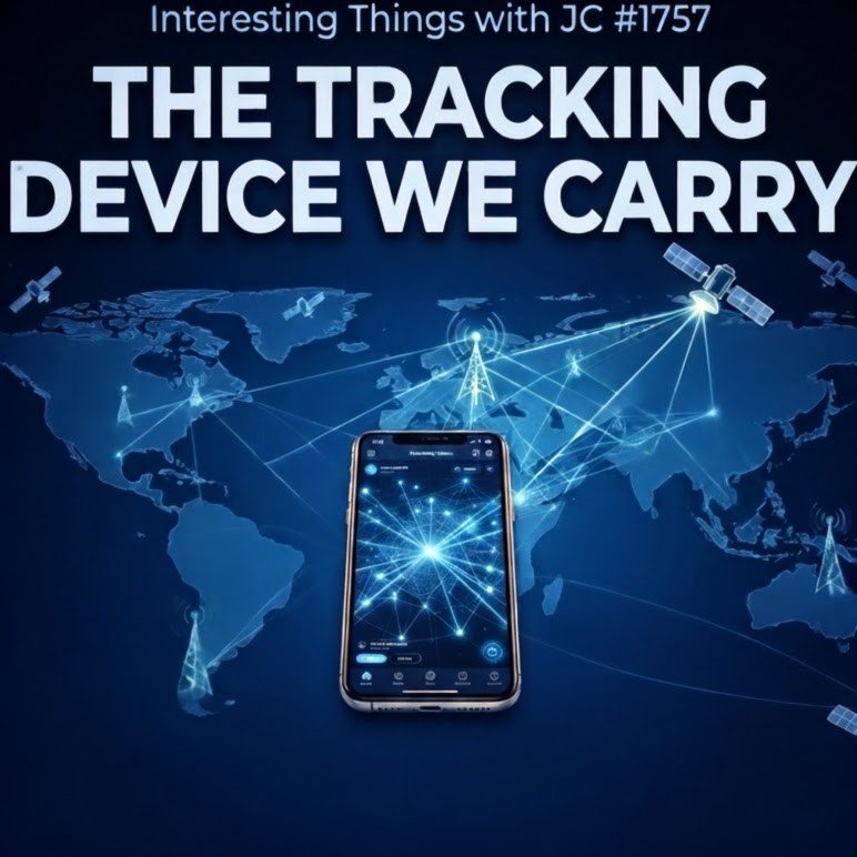
Cover artwork for Interesting Things with JC #1757: The Tracking Device We Carry. A smartphone glows at the center of a blue world map, surrounded by interconnected light points, cell towers, and satellites. Bright lines link the phone, towers, and satellites across the map, visually representing cellular, satellite, and digital location tracking. Large white text at the top reads, “THE TRACKING DEVICE WE CARRY.”
Transcript
Interesting Things with JC #1757:
"The Tracking Device We Carry"
For years, saying your phone could keep a record of where you went sounded paranoid. But a smartphone doesn’t have just one way to determine location. It has several, and they work differently.
The first is the cellular network. A phone that’s powered on communicates with nearby cell sites, and those connections can create time-stamped records known as cell-site location information, or CSLI. The accuracy depends on the network and the size of the cell sector. In the Carpenter v. United States record, urban cell-site data could place a phone within areas ranging from roughly one-eighth to two square miles, while GPS could locate it to around 15 feet, or 4.6 meters.
GPS works differently. The phone receives precisely timed radio signals from satellites and calculates its position from the tiny differences in how long those signals take to arrive. Phones can then combine that calculation with nearby Wi-Fi networks, Bluetooth signals, motion sensors, and cellular information. No single source has to do all the work.
Then there are the apps.
An app given location access can associate coordinates with a mobile advertising identifier, creating data useful for advertising and analytics. Some of that information has moved through a much larger commercial market. The Federal Trade Commission alleged that Mobilewalla collected more than 500 million unique advertising identifiers paired with precise location data between January 2018 and June 2020. The FTC said the information could reveal visits to places including health clinics, houses of worship, political gatherings, and military installations.
That changes the old picture of surveillance. Nobody has to hide a transmitter under your car when the device you already carry can determine its own position and generate records through ordinary network connections and apps.
The legal system eventually had to deal with that reality. In 2018, the Supreme Court ruled in Carpenter that police generally need a warrant to obtain the kind of historical cell-site records involved in that case. The Court understood that years of location records could reconstruct parts of a person's life that once would have required extensive physical surveillance.
And the commercial market didn't disappear. In 2026, the FTC reached a settlement with data broker Kochava and a subsidiary over allegations involving sensitive location information from hundreds of millions of mobile devices.
The science isn't a conspiracy. Satellites transmit timing signals. Cell towers record connections. Wi-Fi and Bluetooth help refine position. Apps can collect coordinates when permissions and system conditions allow it.
What once sounded unlikely became ordinary because location turned out to be useful. We wanted maps, weather, nearby businesses, ride sharing, lost-phone recovery, and local information.
The same technology that can tell you where you are can also leave a record of where you've been.
These are interesting things, with JC.
Student Worksheet
Comprehension
What is cell-site location information, and how is it generated?
How does GPS determine the position of a receiver?
Name three sources other than GPS that a smartphone may use to help determine or refine location.
What did the FTC allege Mobilewalla collected between January 2018 and June 2020?
What general warrant rule did the Supreme Court establish for the historical CSLI at issue in Carpenter v. United States?
Analysis
Why should CSLI and GPS coordinates not automatically be treated as equivalent forms of location evidence?
Explain how combining multiple location sources can make a smartphone more useful.
How does the commercial collection of location information differ from government acquisition of historical CSLI?
Why might repeated location observations reveal more about a person than one isolated location point?
Reflection
Identify one benefit of smartphone location technology and one privacy concern. What principle would you use to balance the two?
Difficulty Scaling
Level 1 — Identify: Accurately name and describe the location technologies presented.
Level 2 — Explain: Compare technologies and explain how location records can be generated or collected.
Level 3 — Evaluate: Develop an evidence-based position about the benefits, privacy implications, or regulation of location information.
Student Output: Complete Questions 1–10. For Questions 6–10, use complete sentences and cite specific evidence from the episode.
Academic Integrity Guidance: Distinguish evidence from inference. Do not claim that every phone, application, company, or location method collects identical information under all conditions. When using outside sources, identify them and paraphrase accurately.
Teacher Guide
Quick Start: Play or read the episode before introducing technical explanations. Ask students to listen for every distinct method or system associated with determining, refining, or recording location.
Pacing Guide — Audio First
0–5 minutes: Bell Ringer and prediction.
5–10 minutes: Play/read episode without interruption.
10–20 minutes: Identify and compare cellular, GPS, Wi-Fi/Bluetooth, and app-related location information.
20–32 minutes: Students complete worksheet Questions 1–8.
32–42 minutes: Discuss Carpenter, Mobilewalla, and Kochava as examples of legal and commercial issues.
42–50 minutes: Reflection, formative check, and Exit Ticket.
Bell Ringer: Without searching online, list every way you think a smartphone might determine or learn something about its location.
Audio Guidance: First exposure should remain uninterrupted. Students should record keywords rather than attempt complete notes.
Audio Fallback: Read the supplied transcript aloud or assign paired reading while preserving the episode's sequence.
Time on Task: Approximately 45–50 minutes for one class period; 70–90 minutes with extension activities.
Materials
Episode audio or transcript
Student worksheet
Internet-enabled research device for optional extension
Board or shared document for a location-technology comparison chart
Vocabulary Prep
Contrast GPS with CSLI before discussing privacy.
Emphasize that "location data" is a broad category rather than one technically uniform record.
Reinforce the distinction between a device calculating its location and another entity retaining or obtaining location-related records.
Misconceptions
GPS is not the only way a smartphone can determine location.
Cell-site records and GPS coordinates do not necessarily provide equal precision.
A phone does not transmit a signal to GPS satellites in order to obtain ordinary GPS positioning; the receiver uses signals broadcast by satellites.
The Carpenter decision did not establish a universal rule governing every conceivable form of digital location information.
Location capabilities do not mean every application continuously receives precise location under every circumstance.
Discussion Prompts
Why is technical precision important when discussing digital surveillance?
Does the usefulness of location services change how society should evaluate location-data collection?
What is the difference between consenting to a useful location feature and understanding every later use of the resulting information?
Why might a long history of movements be more revealing than an individual location point?
Formative Checkpoints
Students can distinguish GPS from CSLI.
Students identify at least four technologies or systems connected to smartphone location.
Students explain why accuracy varies by method and conditions.
Students distinguish commercial data practices from government access to carrier records.
Students support privacy conclusions with episode evidence.
Differentiation
Additional Support: Provide a four-column organizer: Technology, How It Works, Who May Hold the Information, Potential Use.
Advanced Learners: Investigate the limits of the Carpenter holding and distinguish the majority's rule from broader assumptions about digital privacy.
English Learners: Preteach satellite, cellular, identifier, coordinates, warrant, and privacy using diagrams and examples.
Assessment Differentiation: Permit oral responses or a labeled concept map for students requiring alternative expression while retaining the same evidence requirements.
Time Flexibility: For a 30-minute lesson, use Questions 1–5 and 10. For a block period, add source analysis comparing the Supreme Court and FTC materials.
Substitute Readiness: Provide the transcript, worksheet, and vocabulary list. Students can complete the lesson independently without specialized technical knowledge from the instructor.
Engagement Strategy: Have students create a "location pathway" showing how one hypothetical map request could involve a device, signals, an operating system, an app, and stored information without assuming every pathway works identically.
Extensions
Compare smartphone location settings across major operating systems without changing permissions.
Diagram GPS trilateration using distances from known reference points.
Examine how legal rules distinguish government searches from commercial data practices.
Research a career that uses geolocation technology.
Cross-Curricular Connections
Physics: Radio propagation, timing, distance, and signal measurement.
Mathematics: Trilateration, geometry, scale, and measurement uncertainty.
Civics: Fourth Amendment doctrine and judicial responses to technological change.
Computer Science: Sensor fusion, permissions, identifiers, and data systems.
Economics: Commercial value of consumer information.
SEL Connection: Practice respectful discussion when classmates assign different weights to convenience, privacy, safety, and personalization.
Skill Value Emphasis: Evidence evaluation, technical literacy, source distinction, comparative reasoning, and digital citizenship.
Answer Key
CSLI consists of time-stamped records associated with a phone's connections to cellular sites/antennas and can indicate general location.
A GPS receiver uses precisely timed signals from satellites and calculates ranges/position from signal travel time and known satellite information.
Any three: Wi-Fi, Bluetooth, cellular information, motion sensors.
The FTC alleged that Mobilewalla collected more than 500 million unique advertising identifiers paired with precise location data during the stated period.
Police generally need a warrant to obtain the type of historical CSLI involved in Carpenter.
They are produced differently and can have substantially different geographic precision.
Different sources can complement one another when individual signals are limited or unavailable.
Commercial collection concerns businesses collecting, using, or sharing data; Carpenter concerned government acquisition of historical carrier CSLI under the Fourth Amendment.
Repeated observations can reveal patterns of movement and associations that a single point may not disclose.
Answers will vary but must identify a genuine benefit, a plausible privacy concern, and a defensible balancing principle.
Quiz
Multiple Choice
Which technology determines position primarily by receiving precisely timed signals transmitted by satellites?
A. CSLI
B. GPS
C. Mobile advertising identifiers
D. Cellular billingWhat does CSLI primarily document in the episode?
A. Satellite orbital changes
B. Wi-Fi passwords
C. Connections between a phone and cellular infrastructure
D. The contents of text messagesWhy can smartphones use several sources of location information?
A. Each source must always produce identical coordinates.
B. Multiple inputs can contribute to or refine location estimates.
C. GPS requires Bluetooth to communicate with satellites.
D. Cell towers control GPS satellites.What was central to the Supreme Court's decision in Carpenter v. United States?
A. Government acquisition of historical CSLI
B. Ownership of GPS satellites
C. Advertising identifiers used by websites
D. Regulation of Bluetooth hardwareAccording to the episode, why did location technology become ordinary?
A. Location information had no commercial value.
B. Cellular networks eliminated satellite navigation.
C. Location became useful for services such as maps, weather, ride sharing, and device recovery.
D. Smartphones stopped generating network records.
Assessment
Open-Ended Questions
Explain how at least three technologies or systems discussed in the episode can contribute to determining, refining, recording, or collecting smartphone location. Clearly distinguish their roles.
Using Carpenter and one FTC example, explain why smartphone location raises questions that involve both technology and institutions. Support your answer with episode evidence.
3–2–1 Rubric
3 — Proficient: Technically accurate explanation; distinguishes location methods and institutional contexts; uses specific evidence; reasoning is clear and complete.
2 — Developing: Mostly accurate explanation with relevant evidence but contains an incomplete distinction, minor error, or underdeveloped reasoning.
1 — Beginning: Limited explanation, significant technical confusion, unsupported conclusions, or insufficient evidence.
Exit Ticket: In two sentences, explain why "my phone knows where I am" is an incomplete description of smartphone location technology.
Standards Alignment
NGSS — Science & Engineering Practices
SEP — Analyzing and Interpreting Data — Students compare the precision and meaning of different forms of location information and explain how measurement characteristics affect interpretation.
SEP — Obtaining, Evaluating, and Communicating Information — Students extract technical and legal claims from the episode and communicate distinctions among GPS, CSLI, and app-related location information.
CCSS Reading
CCSS.ELA-LITERACY.RST.11-12.1 — Cite specific textual evidence to support analysis of science and technical texts — Students use episode evidence to explain smartphone positioning and location records.
CCSS.ELA-LITERACY.RI.11-12.7 — Integrate and evaluate multiple sources of information presented in different media or formats — Students connect audio/transcript information with legal and technical source material.
CCSS Writing
CCSS.ELA-LITERACY.WHST.11-12.1 — Write arguments focused on discipline-specific content — Students develop evidence-based positions concerning benefits and privacy implications of location technology.
CCSS.ELA-LITERACY.WHST.11-12.9 — Draw evidence from informational texts to support analysis, reflection, and research — Assessment responses require students to distinguish claims and support conclusions with evidence.
C3 Framework
D2.Civ.4.9-12 — Explain how the U.S. Constitution establishes a system of government that has powers, responsibilities, and limits that have changed over time and that are still contested — Students examine how Fourth Amendment doctrine was applied to historical CSLI in Carpenter.
D4.1.9-12 — Construct arguments using precise and knowledgeable claims — Students evaluate privacy and technological utility while distinguishing evidence from assumption.
ISTE / CTE
ISTE 1.2 — Digital Citizen — Students examine awareness of data collection, privacy, and responsible management of digital information.
CTE — Information Technology: Students analyze relationships among mobile hardware, networks, software, data, and privacy controls.
Career Readiness Competencies
Critical Thinking: Distinguish technically different sources that may be grouped under the broad term "location data."
Information Literacy: Evaluate primary government and legal sources against claims in a secondary narrative.
Technology Literacy: Explain how location technologies interact without assuming a single universal tracking mechanism.
Communication: Present evidence-based explanations of technically and legally complex issues.
Homeschool/Lifelong Learning
Learners can independently audit location permissions, compare primary-source descriptions of location technology, and explain privacy choices using technical evidence rather than generalized assumptions.
Show Notes
"The Tracking Device We Carry" examines how smartphones determine and generate information about location through cellular networks, GPS, nearby wireless signals, sensors, and apps. The episode connects the underlying science to Carpenter v. United States and Federal Trade Commission actions involving commercial location data. For classrooms, it provides an interdisciplinary entry point into physics, digital literacy, civics, privacy, and evidence evaluation. It matters because technologies used for navigation, weather, ride sharing, device recovery, and local information can also create or contribute to records of movement.
References
Federal Trade Commission. (2024). FTC takes action against Mobilewalla for collecting and selling sensitive location data. https://www.ftc.gov/news-events/news/press-releases/2024/12/ftc-takes-action-against-mobilewalla-collecting-selling-sensitive-location-data
Federal Trade Commission. (2024). Complaint: In the Matter of Mobilewalla, Inc. https://www.ftc.gov/system/files/ftc_gov/pdf/Mobilewalla-Complaint.pdf
Federal Trade Commission. (2026). FTC v. Kochava, Inc. https://www.ftc.gov/legal-library/browse/cases-proceedings/ftc-v-kochava-inc
Federal Trade Commission. (2026). FTC to ban Kochava and subsidiary from selling sensitive location data to settle charges they sold location data linked to millions of mobile devices. https://search.ftc.gov/news-events/news/press-releases/2026/05/ftc-ban-kochava-subsidiary-selling-sensitive-location-data-settle-charges-they-sold-location-data
National Coordination Office for Space-Based Positioning, Navigation, and Timing. (n.d.). GPS. https://www.gps.gov/gps
National Coordination Office for Space-Based Positioning, Navigation, and Timing. (n.d.). GPS accuracy. https://www.gps.gov/gps-accuracy
National Coordination Office for Space-Based Positioning, Navigation, and Timing. (n.d.). Trilateration. https://www.gps.gov/trilateration
Supreme Court of the United States. (2018). Carpenter v. United States, 585 U.S. 296. https://www.supremecourt.gov/opinions/17pdf/16-402_h315.pdf