1785: "Why the Desert Floods So Fast"
Interesting Things with JC #1785: "Why the Desert Floods So Fast"
A desert thunderstorm drops rain faster than the ground can absorb it, sending excess water downhill into channels that were dry minutes before. Runoff from across the watershed combines in arroyos, where floodwater can arrive from a storm several miles upstream that never reaches the people standing downstream.
Curriculum - Episode Anchor
Episode Title: Why the Desert Floods So Fast
Episode Number: 1785
Series: Interesting Things with JC
Host: JC
Audience: Grades 9–12, introductory college, homeschool, lifelong learners
Subject Area: Earth science, hydrology, environmental hazards, quantitative reasoning
Central Question: How can a brief thunderstorm send dangerous water through a desert channel that was dry moments earlier?
Core Claim: Flash-flood risk depends on rainfall intensity, infiltration, terrain, vegetation, and the way a watershed concentrates runoff—not on whether the ground looks dry.
Lesson Overview
Learning Objectives
Explain how rainfall becomes surface runoff when it arrives faster than the ground can absorb it.
Trace water from a storm over a watershed into tributaries and an arroyo (uh-ROY-oh).
Calculate rainfall volume and distinguish it from the smaller, variable volume that becomes runoff.
Explain why flooding can reach a location that has received no rain.
Describe how wildfire can change runoff and debris-flow risk.
Essential Distinction: Rainfall volume is the amount of water delivered to an area. Runoff volume is the portion that subsequently flows across the surface or through channels. The episode’s 17.4-million-gallon figure describes rainfall, not a predicted flood volume. The U.S. Geological Survey’s one-square-mile calculation supports that distinction. (U.S. Geological Survey)
Estimated Time: 45–50 minutes
Driving Question: Why does an empty arroyo remain a flood hazard?
Key Vocabulary
Rainfall intensity: The rate at which rain falls, commonly expressed as inches or millimeters per hour.
Infiltration: Water entering the soil from the surface.
Infiltration capacity: The rate at which soil can take in water under particular conditions.
Runoff: Water that flows over land or into channels after rainfall.
Watershed: The land area that drains toward a shared outlet.
Tributary: A smaller channel that feeds a larger one.
Arroyo (uh-ROY-oh): A channel that is often dry but can carry water after rainfall.
Burn scar: Land affected by wildfire, where changes to vegetation and soil may increase runoff.
Debris flow: Rapid movement of water mixed with substantial sediment, rocks, and other material down a slope or channel.
Concept Check: Dry soil is not uniformly unable to absorb water. Infiltration varies with soil structure, surface crusts, rock, slope, vegetation, and storm intensity. Water may also infiltrate through an arroyo bed as a flood passes. (pubs.usgs.gov)
Narrative Core
Precise Storytelling Framework
Opening puzzle: A dangerous flood can appear in a place that has gone weeks without rain.
First mechanism: Rainfall that exceeds infiltration capacity produces surface runoff.
Second mechanism: Slopes and connected drainage channels gather runoff from a wider watershed.
Reveal: Rain upstream can send a flood through a dry arroyo downstream, even under clear skies at the observer’s location.
Scale: One inch over one square mile delivers approximately 17.4 million gallons of rain; only a variable portion becomes runoff.
Complication: Fire can remove vegetation and change soil conditions, increasing runoff and debris hazards.
Resolution: A dry channel is part of an active drainage system. Its current appearance does not establish its flood risk.
Scientific Through-Line: Rainfall rate and surface conditions → runoff generation → downhill movement → channel concentration → possible flash flood. The National Weather Service identifies steep terrain, intense rainfall, and burn scars as contributors to rapid runoff. (weather.gov)
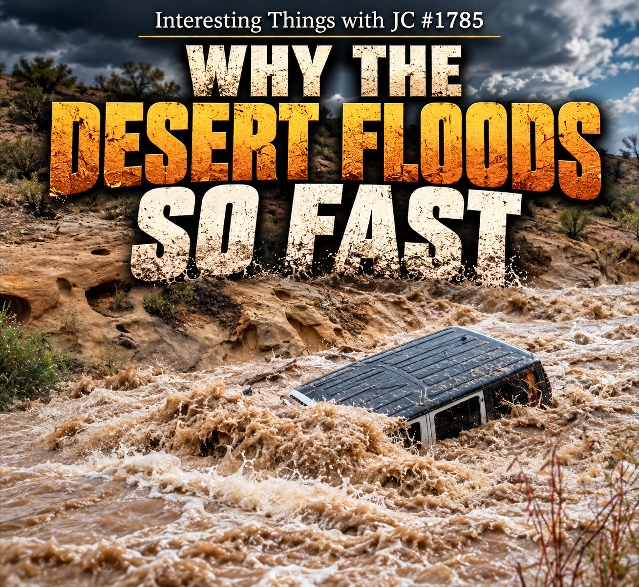
Cinematic cover art showing a violent desert flash flood rushing through a rocky New Mexico landscape under dark storm clouds. Muddy, churning water nearly submerges an SUV in the foreground. Text at the top reads “Interesting Things with JC #1785.” Large centered title text reads “Why the Desert Floods So Fast.”
Transcript
Interesting Things with JC #1785:
"Why the Desert Floods So Fast"
Some of the most dangerous flash floods happen in places that can go weeks without rain, because when a desert thunderstorm finally arrives, the ground may not be able to take in water nearly as fast as the sky can deliver it.
That difference between rainfall rate and infiltration rate is one of the basic pieces of flash-flood hydrology. When rain reaches the surface faster than the soil can absorb it, the excess becomes runoff. And dry ground doesn’t automatically mean absorbent ground. Across New Mexico, exposed rock, compacted surfaces, fine sediments, soil crusts, steep slopes, and sparse vegetation can all affect how much water enters the soil and how much begins moving across it.
Summer thunderstorms can put intense rainfall over a relatively small area in a short period of time. Once rainfall exceeds the ground’s infiltration capacity, water moves downhill. Small sheets and rivulets merge, tributaries feed larger channels, and the drainage network concentrates runoff from across the watershed.
That is where arroyos come in. These normally dry channels occupy the low paths shaped by previous flows, making them efficient routes for runoff. An arroyo can be completely dry where you are while a thunderstorm several miles upstream is already sending water toward it. The flood can arrive before the storm does, or without the storm ever reaching you.
The amount of water involved can be enormous. One inch of rain, about 25 millimeters, falling across one square mile, or 2.6 square kilometers, represents roughly 17.4 million gallons, about 65.8 million liters. Eight inches across that same area would be about 139 million gallons, or more than 526 million liters.
Not all of that becomes runoff. Some infiltrates, some is intercepted by vegetation, and some collects temporarily in depressions and channels. But a storm doesn’t have to convert all its rainfall into runoff to create a dangerous flood. It only has to deliver water faster than the landscape can absorb, store, and carry it.
Wildfire can push that balance further. A severe fire can remove vegetation and alter the soil, reducing infiltration and increasing runoff. On steep burn scars, moving water can also pick up ash, sediment, branches, rocks, and other debris, making the resulting flow heavier and more destructive.
These are interesting things, with JC.
Student Worksheet
Comprehension
Define infiltration and runoff. What relationship between rainfall intensity and infiltration capacity can produce surface runoff?
Describe the route water might follow from a hillside into an arroyo. Use watershed and tributary in your answer.
Explain how an arroyo can flood when no rain is falling at your location.
Name three landscape features or conditions from the episode that can affect infiltration or runoff.
Quantitative Reasoning
5. One inch of rain over one square mile is approximately 17.4 million gallons. How much rain falls over the same area if the depth is 2 inches? How much if it is 8 inches?
6. For a simplified model, assume 25% of the 2-inch rainfall in Question 5 becomes runoff. Calculate that runoff volume. State why the percentage is an assumption, rather than a prediction for a real storm.
7. A second hypothetical storm drops the same amount of rain, but 50% becomes runoff. Compare the two runoff volumes. Give two possible reasons the fractions could differ.
Analysis
8. Draw a labeled watershed diagram showing a storm upstream, two tributaries, an arroyo, and a downstream observer under clear skies. Use arrows to show water movement.
9. Evaluate the claim: “If desert ground is dry, it will soak up rain quickly enough to prevent a flood.” Write a response using at least three factors from the episode.
10. Explain how a burn scar might affect both the amount of runoff and the material carried by moving water.
Reflection
11. Write a two-sentence public safety explanation for someone who sees a dry arroyo on a sunny day. Explain the upstream hazard without implying that every dry arroyo will flood.
Student Output: Submit calculations with units, a labeled diagram, and written answers to Questions 1–4 and 7–11.
Academic Integrity Guidance: Distinguish episode facts from the hypothetical percentages in Questions 6–7. Cite the episode or a supplied source when using outside evidence.
Teacher Guide
Quick Start: Play the episode once without interruption. Ask students to write a one-sentence answer to the driving question. Replay the rainfall-volume passage before the calculations.
Pacing Guide — Audio First
0–5 minutes: Ask whether a location can flood without receiving rain; collect initial explanations.
5–10 minutes: Play the episode and identify rainfall, infiltration, runoff, and channel flow.
10–20 minutes: Have students complete Questions 1–4 and compare causal explanations.
20–32 minutes: Work Questions 5–7, requiring units and explicit assumptions.
32–43 minutes: Draw the watershed model and discuss upstream rain and burn scars.
43–50 minutes: Collect Question 11 as an exit ticket.
Materials
Episode audio or transcript
Paper or digital drawing surface
Calculator
Optional: a local topographic or watershed map for an extension
Answer Key
1: Infiltration is water entering soil; runoff is water moving across land or into channels. Rainfall exceeding the ground’s capacity to absorb it can generate runoff.
2: Water moves downhill over a watershed, enters small flow paths and tributaries, then concentrates in the arroyo.
3: Rain upstream can generate runoff that travels through the connected drainage network to the observer’s location.
4: Accept exposed rock, compacted ground, fine sediment, crusts, steep slope, sparse vegetation, or wildfire effects, with a sound explanation.
5: 34.8 million gallons at 2 inches; 139.2 million gallons at 8 inches. The episode rounds the latter to about 139 million.
6: 0.25 × 34.8 million = 8.7 million gallons in the simplified model. A real runoff fraction depends on storm and watershed conditions.
7: 0.50 × 34.8 million = 17.4 million gallons, twice the Question 6 result. Possible explanations include different rainfall intensity, infiltration, vegetation, surface crusting, slope, or fire effects.
8: Look for a connected upstream-to-downstream path and a clear distinction between the storm’s location and the observer’s.
9: Reject the blanket claim. Dryness alone does not establish infiltration capacity; require three relevant factors and a causal explanation.
10: Loss of vegetation or altered soil can increase runoff; faster flow on steep ground may entrain ash, sediment, rocks, and branches.
11: Accept a concise explanation that upstream rainfall can send water into a locally dry channel and that people should stay out of channels when flood risk is present.
Likely Misconceptions
“Seventeen-point-four million gallons means 17.4 million gallons will flood downstream.” That number describes rain falling on the specified area.
“All dry ground repels water.” Some dry surfaces infiltrate well; conditions vary.
“A storm must pass overhead to create a local flood.” The drainage area can extend miles upstream.
“Every post-fire flood is a debris flow.” Debris flows are a distinct possible hazard, not the outcome of every rainstorm.
Differentiation
Additional Support: Provide a watershed outline and the calculation frame rainfall volume × assumed runoff fraction.
Advanced Learners: Compare two storm scenarios that have equal total rainfall but different rainfall rates; explain why runoff could differ.
English Learners: Pair each vocabulary term with a labeled diagram and a plain-language definition before replaying the audio.
Extension: Use an official watershed map to identify high ground, tributaries, channels, and downstream locations. Students should describe possible flow paths without attempting to forecast a particular flood.
Quiz
Multiple choice: Which condition can directly generate surface runoff?
A. Rainfall arrives faster than the surface can absorb it.
B. The ground has been dry for one week.
C. An arroyo has no water in it.
D. The storm is visible downstream.Short answer: What is a watershed?
Multiple choice: Why might an arroyo flood beneath clear skies?
A. Clear skies produce runoff.
B. Rain fell upstream in its watershed.
C. All arroyos contain underground rivers.
D. A dry channel cannot flood.Calculation: Approximately how many gallons of rain fall on one square mile under 3 inches of rainfall? Use 17.4 million gallons per inch.
Short answer: Give one reason the answer to Question 4 is not automatically the runoff volume.
Multiple choice: Which change after a severe wildfire can raise flash-flood risk?
A. More vegetation intercepting rainfall
B. Less available sediment
C. Loss of vegetation and altered soil conditions
D. A flatter watershedShort answer: Explain the difference between a flash flood and a debris flow using this lesson’s terminology.
Evidence-based response: Give two reasons the phrase “deserts flood because their soil is dry” is incomplete.
Quiz Key: 1. A; 2. Land draining to a common outlet; 3. B; 4. 52.2 million gallons; 5. Some water infiltrates, is intercepted, or is stored temporarily; 6. C; 7. A flash flood involves rapidly rising or moving floodwater, while a debris flow contains substantial moving sediment and debris; 8. Accept two supported factors such as rainfall intensity, infiltration capacity, rock, crusts, slope, vegetation, wildfire, or drainage-network shape.
Assessment
Performance Task: Create a one-page illustrated explanation for a hypothetical community beside a normally dry arroyo. Show how an upstream storm could produce downstream flooding. Include one rainfall-volume calculation, identify at least three watershed factors, and state why rainfall volume alone cannot predict the runoff volume.
Assessment Rubric — 16 Points
Hydrologic mechanism, 0–4: Correctly connects rainfall intensity, infiltration, runoff, and channel concentration.
Watershed model, 0–4: Accurately shows upstream rainfall, tributaries, the arroyo, and the downstream location.
Quantitative reasoning, 0–4: Calculates with correct units and distinguishes rainfall volume from assumed or estimated runoff.
Communication and evidence, 0–4: Explains the hazard clearly, acknowledges uncertainty, and grounds claims in the episode or supplied sources.
Proficiency Benchmark: At least 12/16, including a correct distinction between rainfall and runoff.
Formative Checkpoints: Use the initial one-sentence prediction, Question 7’s comparison, and the exit ticket to locate misunderstandings before scoring the performance task.
Standards Alignment
NGSS — Science & Engineering Practices
HS-ESS2-5 — Plan and conduct an investigation of the properties of water and its effects on Earth materials and surface processes. Students analyze infiltration, runoff, erosion, and channel flow and can model how water interacts with contrasting surfaces.
Developing and Using Models. Students construct a causal model connecting precipitation, infiltration, surface characteristics, topography, runoff, and drainage channels.
Analyzing and Interpreting Data. Students use rainfall-volume quantities and hypothetical runoff percentages to interpret watershed-scale water movement.
CCSS Reading
CCSS.ELA-LITERACY.RST.9-10.1 — Cite specific textual evidence to support analysis of science and technical texts. Students support explanations of flash-flood mechanisms with evidence from the episode transcript.
CCSS.ELA-LITERACY.RST.11-12.3 — Follow precisely a complex multistep procedure when carrying out experiments, taking measurements, or performing technical tasks. Students can apply this skill during an optional watershed/runoff model.
CCSS Writing
CCSS.ELA-LITERACY.WHST.9-10.2 — Write informative/explanatory texts. Students construct evidence-based explanations connecting rainfall intensity, infiltration, runoff, and watershed structure.
CCSS.ELA-LITERACY.WHST.11-12.9 — Draw evidence from informational texts to support analysis, reflection, and research. Students use transcript evidence when answering analytical assessment questions.
C3 Framework
D2.Geo.2.9-12 — Use maps, satellite images, photographs, and other representations to explain relationships between locations of places and regions and their political, cultural, and economic dynamics. An extension has students use watershed or topographic representations to reason spatially about runoff pathways.
D2.Geo.10.9-12 — Evaluate how changes in the environmental characteristics of a place or region influence spatial patterns of trade and land use. Students can extend their analysis to how flood-prone drainage features affect land-use and infrastructure decisions.
ISTE / CTE — Applied Learning
Knowledge Constructor: Students evaluate authoritative hydrologic and meteorological information and connect evidence from multiple representations.
Computational Thinker: Students use quantitative rainfall and runoff relationships to examine a physical system.
Career Readiness Competencies
Quantitative Reasoning: Calculate and interpret water volumes and runoff percentages.
Systems Thinking: Explain interactions among atmospheric, geological, biological, and hydrological variables.
Risk Communication: Translate watershed science into clear explanations of environmental hazards.
Spatial Reasoning: Interpret how slope, channels, and drainage networks move water across landscapes.
Homeschool/Lifelong Learning
Learners can connect observable landforms to watershed processes, use authoritative weather information, calculate rainfall volumes, and explain environmental hazards using evidence rather than assumptions.
Show Notes
Episode Summary: A desert flash flood develops when intense rainfall interacts with the land’s ability to absorb water and the watershed’s ability to concentrate it. The episode follows runoff into normally dry arroyos, explains how floods can arrive from storms upstream, and examines why wildfire can intensify the hazard.
Key Figure: One inch of rain over one square mile is about 17.4 million U.S. gallons (65.8 million liters); eight inches is about 139 million gallons (526 million liters). These figures measure precipitation over an area, not the amount that will reach a particular channel. (U.S. Geological Survey)
Classroom Use: Free curriculum materials available on the website, no login, no paywall.
Watch: youtube.com/@interestingthingswithjc
RSS/MP3 & Curriculum: JimConnors.net
Use Note: Free classroom use with attribution to Interesting Things with JC and Jim Connors; no resale.
References
U.S. Geological Survey. Watersheds and Drainage Basins. Explains drainage areas, infiltration, and the one-square-mile rainfall calculation. (U.S. Geological Survey)
U.S. Geological Survey. Rain and Precipitation. Provides rainfall-volume conversions in U.S. and metric units. (U.S. Geological Survey)
U.S. Geological Survey. Hydrologic Cycle and Interactions. Describes overland flow when rainfall exceeds infiltration capacity in arid settings. (pubs.usgs.gov)
National Weather Service, Albuquerque. North American Monsoon Flash Floods. Explains local flash-flood conditions and burn-scar hazards in New Mexico. (weather.gov)
U.S. Geological Survey. Streamflow, Infiltration, and Ground-Water Recharge at Abo Arroyo, New Mexico. Documents that water can infiltrate through an arroyo bed, an important limit on simple runoff assumptions. (U.S. Geological Survey)